IMAGES TAKEN NEAR TO
Clarence Street, SUNDERLAND, SR5 2HD

Introduction

This page details the photographs taken nearby to Clarence Street, SR5 2HD by members of the Geograph project.

The Geograph project started in 2005 with the aim of publishing, organising and preserving representative images for every square kilometre of Great Britain, Ireland and the Isle of Man.

There are currently over 7.5m images from over14,400 individuals and you can help contribute to the project by visiting https://www.geograph.org.uk

Image Map


Images are licensed for reuse under creativecommons.org/licenses/by-sa/2.0
Notes
  • Clicking on the map will re-center to the selected point.
  • The higher the marker number, the further away the image location is from the centre of the postcode.

Image Listing (18 Images Found)

Images are licensed for reuse under creativecommons.org/licenses/by-sa/2.0
Image
Details
Distance
1
Darwin Street, Southwick, Sunderland
Single-storey 2-bedroom houses, typical of many in this area and dating from the turn of the 20th century.
Image: © Brian Abbott Taken: 11 May 2006
0.07 miles
2
Holy Trinity Church, Southwick, Sunderland
Image: © JThomas Taken: 18 Aug 2018
0.11 miles
3
Houses on Broadsheath Terrace, Sunderland
Image: © JThomas Taken: 18 Aug 2018
0.16 miles
4
Back alley in Sunderland
This alley passes along the back of two rows of houses.
Image: © Malc McDonald Taken: 20 Apr 2014
0.18 miles
5
C2C at the northern end of the Queen Alexandra Bridge
The world-famous C2C cycle route passes by means of subways through the middle of the gyratory system on the A1231.
Image: © Oliver Dixon Taken: 19 Jun 2015
0.18 miles
6
Bristol Street Motors
Leaving Silverbriar.
Image: © Steve Fareham Taken: 5 Jun 2008
0.19 miles
7
North Hylton Road, Sunderland
Image: © Malc McDonald Taken: 20 Apr 2014
0.19 miles
8
Burntland Avenue, Sunderland
Image: © Malc McDonald Taken: 20 Apr 2014
0.19 miles
9
Oaklands Crescent, Sunderland
The markings painted on the road indicate that this road has a speed limit of 20 miles per hour.
Image: © Malc McDonald Taken: 20 Apr 2014
0.20 miles
10
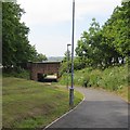
Cycle path, Southwick
It is using the trackbed of the Hylton, Southwick and Monk Wearmouth branch of the North Eastern Railway.
Image: © Richard Webb Taken: 18 Jun 2013
0.22 miles