IMAGES TAKEN NEAR TO
Waterside, SUNDERLAND, SR4 9JS
Introduction
This page details the photographs taken nearby to Waterside, SR4 9JS by members of the Geograph project.
The Geograph project started in 2005 with the aim of publishing, organising and preserving representative images for every square kilometre of Great Britain, Ireland and the Isle of Man.

There are currently over 7.5m images from over14,400 individuals and you can help contribute to the project by visiting https://www.geograph.org.uk
Image Map
Images are licensed for reuse under creativecommons.org/licenses/by-sa/2.0
Notes
- Clicking on the map will re-center to the selected point.
- The higher the marker number, the further away the image location is from the centre of the postcode.
Image Listing (41 Images Found)
Images are licensed for reuse under creativecommons.org/licenses/by-sa/2.0
Image
Details
Distance
1
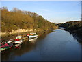
River Wear looking East from Cox Green
Image: © gordon james brown
Taken: 30 Sep 2012
0.03 miles
2
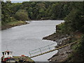
River Wear near Cox Green
A ferry crossing is shown here on the 1940 OS map but now there is a foot bridge. This view is downriver (east).
Image: © Alan Fearon
Taken: 19 Nov 2005
0.03 miles
3
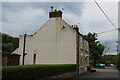
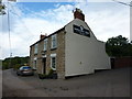
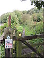
Oddfellows Arms, Cox Green
Watering hole passed by on the Weardale Way long distance footpath
Image: © Chris Heaton
Taken: 18 May 2023
0.03 miles
5
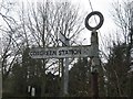
Old Direction Sign - Signpost by Cox Green, Sunderland parish
Annulus finial - 1 arm; by the UC road, in parish of Sunderland (Sunderland District), Cox Green, opposite Oddfellows PH, on river bank.
Surveyed
Milestone Society National ID: DU_NZ3255
Image: © Milestone Society
Taken: Unknown
0.04 miles
6
Footpath along river Wear at Cox Green
Image: © gordon james brown
Taken: 30 Sep 2012
0.04 miles
7
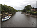
River Wear looking East from Cox Green footbridge
Image: © gordon james brown
Taken: 30 Sep 2012
0.04 miles
8
Weardale Way at Cox Green, near Washington
An old signpost points to Coxgreen Station. However, anyone wanting to catch a train will be disappointed, as the last train left in 1964.
The Weardale Way long distance footpath goes straight ahead here, towards South Hylton and Sunderland. More information about the Weardale Way is available from the Long Distance Walkers' Association: https://www.ldwa.org.uk/ldp/members/show_path.php?path_name=Weardale+Way
Image: © Malc McDonald
Taken: 29 Oct 2016
0.04 miles
9
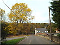
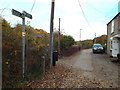
Cox Green, near Washington
A view of Cox Green, on the bank of the River Wear near Washington.
This image was taken during autumn, as the leaves on the trees were turning golden then falling.
Image: © Malc McDonald
Taken: 29 Oct 2016
0.05 miles
10
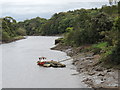
River Wear looking East from Cox Green footbridge
Image: © gordon james brown
Taken: 30 Sep 2012
0.06 miles