IMAGES TAKEN NEAR TO
Parkmore Road, SUNDERLAND, SR4 9DU
Introduction
This page details the photographs taken nearby to Parkmore Road, SR4 9DU by members of the Geograph project.
The Geograph project started in 2005 with the aim of publishing, organising and preserving representative images for every square kilometre of Great Britain, Ireland and the Isle of Man.

There are currently over 7.5m images from over14,400 individuals and you can help contribute to the project by visiting https://www.geograph.org.uk
Image Map
Images are licensed for reuse under creativecommons.org/licenses/by-sa/2.0
Notes
- Clicking on the map will re-center to the selected point.
- The higher the marker number, the further away the image location is from the centre of the postcode.
Image Listing (6 Images Found)
Images are licensed for reuse under creativecommons.org/licenses/by-sa/2.0
Image
Details
Distance
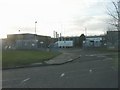
4
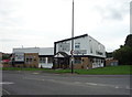
The Hastings Hill, Sunderland
Pub and restaurant on Chester Road, Sunderland
Image: © JThomas
Taken: 18 Aug 2018
0.24 miles
6
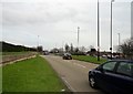
Approaching a roundabout on Chester Road
This is at the junction with Greenwood Road at Grindon, one of the western sub. of Sunderland.
Image: © Robert Graham
Taken: 15 Mar 2017
0.24 miles