IMAGES TAKEN NEAR TO
Ettrick Grove, SUNDERLAND, SR4 8PZ
Introduction
This page details the photographs taken nearby to Ettrick Grove, SR4 8PZ by members of the Geograph project.
The Geograph project started in 2005 with the aim of publishing, organising and preserving representative images for every square kilometre of Great Britain, Ireland and the Isle of Man.

There are currently over 7.5m images from over14,400 individuals and you can help contribute to the project by visiting https://www.geograph.org.uk
Image Map
Images are licensed for reuse under creativecommons.org/licenses/by-sa/2.0
Notes
- Clicking on the map will re-center to the selected point.
- The higher the marker number, the further away the image location is from the centre of the postcode.
Image Listing (22 Images Found)
Images are licensed for reuse under creativecommons.org/licenses/by-sa/2.0
Image
Details
Distance
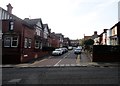
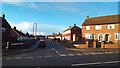
2
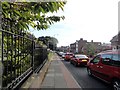
Heavy traffic on Chester Road
Heading into Sunderland city centre in the morning rush hour.
Image: © Robert Graham
Taken: 3 Oct 2016
0.06 miles
4
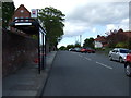
Bus stop and shelter on Ettrick Grove
Looking north.
Image: © JThomas
Taken: 28 May 2015
0.08 miles
5
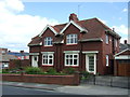
West Mount, off Chester Road
Street of solid suburban houses in the High Barnes area of the city.
Image: © Robert Graham
Taken: 3 Oct 2016
0.08 miles
6

Entrance lodge at Bishopwearmouth cemetery
Victorian entrance lodge built in 1856, at the Chester Road entrance.
Image: © Robert Graham
Taken: 3 Oct 2016
0.09 miles
7
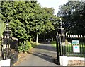
Entrance gates to Bishopwearmouth cemetery
On Chester Road, west of Sunderland city centre. These are grade 2 listed, built in 1856.
Image: © Robert Graham
Taken: 3 Oct 2016
0.09 miles
8
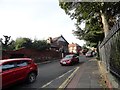
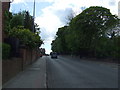
Looking west along Chester Road
In the High Barnes area of Sunderland. This is a major route west from the city centre.
Image: © Robert Graham
Taken: 3 Oct 2016
0.12 miles
9
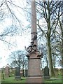
Naval Memorial, Bishopwearmouth Cemetery
Granite memorial depicting a broken mast and the foul anchor of the Royal Navy
Image: © Peter Wilkinson
Taken: 4 Apr 2003
0.12 miles
10
Beldene Drive, Sunderland
Suburban housing in the High Barnes area of Sunderland.
Image: © Malc McDonald
Taken: 22 Dec 2013
0.12 miles