IMAGES TAKEN NEAR TO
St. Lukes Road, SUNDERLAND, SR4 0HB
Introduction
This page details the photographs taken nearby to St. Lukes Road, SR4 0HB by members of the Geograph project.
The Geograph project started in 2005 with the aim of publishing, organising and preserving representative images for every square kilometre of Great Britain, Ireland and the Isle of Man.

There are currently over 7.5m images from over14,400 individuals and you can help contribute to the project by visiting https://www.geograph.org.uk
Image Map
Images are licensed for reuse under creativecommons.org/licenses/by-sa/2.0
Notes
- Clicking on the map will re-center to the selected point.
- The higher the marker number, the further away the image location is from the centre of the postcode.
Image Listing (26 Images Found)
Images are licensed for reuse under creativecommons.org/licenses/by-sa/2.0
Image
Details
Distance
1
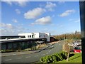
North View School, Sunderland
A special needs school in South Hylton.
Image: © Robert Graham
Taken: 20 Feb 2018
0.01 miles
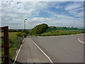
2
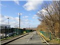
Keelman's Lane, Sunderland
This lane leads down from St Luke's Road down to the River Wear at South Hylton. The name must refer to the boatmen who transferred coal to sea going colliers back in earlier centuries.
Image: © Robert Graham
Taken: 20 Feb 2018
0.04 miles
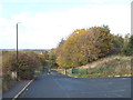
3
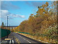
Keelman's Lane, Sunderland
Keelman's lane on the outskirts of Sunderland.
This image was taken on an Octoebr day. Leaves on the trees were turning golden yellow.
Image: © Malc McDonald
Taken: 27 Oct 2018
0.04 miles
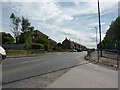
5
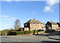
Suburban estate at South Hylton
One of the western suburbs of Sunderland. This is the junction of Prestwick Road with St Luke's Road.
Image: © Robert Graham
Taken: 20 Feb 2018
0.05 miles
6
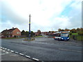
Bus turning circle at Pennywell, Sunderland
A bus turning circle at Pennywell, a suburb of Sunderland. A bus operated by Stagecoach waits for departure time for its next journey.
Image: © Malc McDonald
Taken: 27 Oct 2018
0.06 miles
7
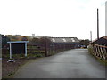
Driveway to Sunderland Training and Education Farm
A driveway leading to a farm which has become a training and education venue.
The website for Sunderland Training & Education Farm is here: http://www.sunderlandfarm.co.uk/
In the distance, the Penshaw Monument looms on top of a hill.
Image: © Malc McDonald
Taken: 27 Oct 2018
0.08 miles
10
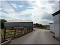
Path from Keelman's Lane, Sunderland
Keelman's Lane ends at this point. A path continues northwards beyond the gate.
This image was taken on an October day, as the leaves were turning golden yellow.
Image: © Malc McDonald
Taken: 27 Oct 2018
0.10 miles