IMAGES TAKEN NEAR TO
Oakfield Close, SUNDERLAND, SR3 3SA
Introduction
This page details the photographs taken nearby to Oakfield Close, SR3 3SA by members of the Geograph project.
The Geograph project started in 2005 with the aim of publishing, organising and preserving representative images for every square kilometre of Great Britain, Ireland and the Isle of Man.

There are currently over 7.5m images from over14,400 individuals and you can help contribute to the project by visiting https://www.geograph.org.uk
Image Map
Images are licensed for reuse under creativecommons.org/licenses/by-sa/2.0
Notes
- Clicking on the map will re-center to the selected point.
- The higher the marker number, the further away the image location is from the centre of the postcode.
Image Listing (33 Images Found)
Images are licensed for reuse under creativecommons.org/licenses/by-sa/2.0
Image
Details
Distance
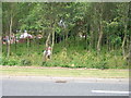

4
Power supply in form of National Grid to Doxford International
Image: © rob bishop
Taken: 10 Jul 2006
0.09 miles
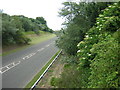
5
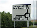
Road sign on approach to Doxford International Business Park
Image: © rob bishop
Taken: 10 Jul 2006
0.09 miles

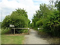
7
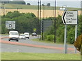
Road leading to Doxford International Business Park with green belt
Image: © rob bishop
Taken: 10 Jul 2006
0.12 miles
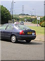
8
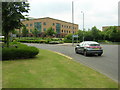
Entrance to Doxford International Business Park
Image: © rob bishop
Taken: 10 Jul 2006
0.12 miles