1
Midsomer Close, Moorside, Sunderland
Midsomer Close is a residential cul-de-sac in the Moorside district of Sunderland.
Image: © Malc McDonald
Taken: 21 Apr 2019
0.04 miles
2
W2W cycle route near Sunderland
The Walney to Wear (W2W) cycle route in woodland on the outskirts of Sunderland.
The path here is shared by cyclists, walkers and horse riders.
Image: © Malc McDonald
Taken: 21 Apr 2019
0.06 miles
3
Former railway path near Sunderland
This path, which is shared by walkers, cyclists and horse riders, is on the trackbed of the former Hetton Colliery Railway. It is on the route of the Walney to Wear (W2W) cycle route.
Image: © Malc McDonald
Taken: 21 Apr 2019
0.12 miles
4
Markby Close, Moorside, Sunderland
Markby Close is a residential cul-de-sac in the Moorside area of Sunderland.
Image: © Malc McDonald
Taken: 21 Apr 2019
0.12 miles
5
Path through housing at Moorside, Sunderland
A path through a housing estate at Moorside, in the suburbs of Sunderland.
Image: © Malc McDonald
Taken: 21 Apr 2019
0.17 miles
6
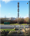
Telecoms mast in Doxford International Business Park
Doxford International Business Park is close to the East Herrington and Doxford districts of Sunderland.
Image: © Trevor Littlewood
Taken: 15 Feb 2018
0.20 miles
7
Business Park looking Southwards
Image: © rob bishop
Taken: 25 Jul 2007
0.21 miles
8
Farmland sandwiched between Moorside and Doxford Park Business Park
Image: © Clive Nicholson
Taken: 5 Jul 2013
0.21 miles
9
Cultivated farmland at Moorside
Image: © Clive Nicholson
Taken: 8 Apr 2014
0.23 miles
10
Maree Close, Moorside, Sunderland
Maree Close is a residential cul-de-sac in the suburbs of Sunderland.
Image: © Malc McDonald
Taken: 21 Apr 2019
0.23 miles


