IMAGES TAKEN NEAR TO
Paddock Lane, SUNDERLAND, SR3 2BX

Introduction

This page details the photographs taken nearby to Paddock Lane, SR3 2BX by members of the Geograph project.

The Geograph project started in 2005 with the aim of publishing, organising and preserving representative images for every square kilometre of Great Britain, Ireland and the Isle of Man.

There are currently over 7.5m images from over14,400 individuals and you can help contribute to the project by visiting https://www.geograph.org.uk

Image Map


Images are licensed for reuse under creativecommons.org/licenses/by-sa/2.0
Notes
  • Clicking on the map will re-center to the selected point.
  • The higher the marker number, the further away the image location is from the centre of the postcode.

Image Listing (8 Images Found)

Images are licensed for reuse under creativecommons.org/licenses/by-sa/2.0
Image
Details
Distance
1
New houses in Tunstall, Sunderland
Newly-built houses in Tunstall, a district of Sunderland.
Image: © Malc McDonald Taken: 21 Apr 2019
0.03 miles
2
Houses on Tunstall Village Green
Image: © JThomas Taken: 10 Nov 2012
0.08 miles
3
Tunstall Village Green
Image: © JThomas Taken: 10 Nov 2012
0.09 miles
4
Merryweather Rise, Tunstall, Sunderland
Merryweather Rise is a residential cul-de-sac built in 2005, in Tunstall to the south of Sunderland.
Image: © Malc McDonald Taken: 21 Apr 2019
0.12 miles
5
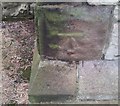
Ordnance Survey Cut Mark
This OS cut mark can be found on the SE face of St Leonard's Church. It marks a point 88.605m above mean sea level.
Image: © Adrian Dust Taken: 20 Sep 2018
0.13 miles
6
Tunstall Hope Road, Sunderland
Signs warn of a double bend, the road narrowing and a steep downhill gradient ahead. Just visible in the distance, to the left of the image, is the Northern Spire bridge which opened in 2018.
Image: © Malc McDonald Taken: 21 Apr 2019
0.13 miles
7
Tunstall Hope Road, Sunderland
Tunstall Hope Road in a rural area of Sunderland.
Image: © Malc McDonald Taken: 21 Apr 2019
0.20 miles
8
Venerable Bede school, Tunstall Bank
A Church of England secondary school.
Image: © Roger Cornfoot Taken: 16 Apr 2007
0.24 miles