
IMAGES TAKEN NEAR TO
Padstow Place, FORDINGBRIDGE, SP6 1BT
Introduction
This page details the photographs taken nearby to Padstow Place, SP6 1BT by members of the Geograph project.
The Geograph project started in 2005 with the aim of publishing, organising and preserving representative images for every square kilometre of Great Britain, Ireland and the Isle of Man.

There are currently over 7.5m images from over14,400 individuals and you can help contribute to the project by visiting https://www.geograph.org.uk
Image Map
Images are licensed for reuse under creativecommons.org/licenses/by-sa/2.0
Notes
- Clicking on the map will re-center to the selected point.
- The higher the marker number, the further away the image location is from the centre of the postcode.
Image Listing (134 Images Found)
Images are licensed for reuse under creativecommons.org/licenses/by-sa/2.0
Image
Details
Distance
1
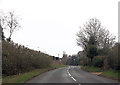
Bowerwood Road approaching Padstow Place
Image: © John Firth
Taken: 13 Apr 2013
0.05 miles
2
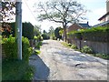
Fordingbridge, Frog Lane
Private road with footpath, from Church Street towards Midgham Farm.
Image: © Mike Faherty
Taken: 22 Oct 2011
0.06 miles
3
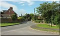
Bowerwood Road, Fordingbridge
The B3078, seen from the junction with Mulberry Gardens.
Image: © Derek Harper
Taken: 16 Jul 2016
0.07 miles
4
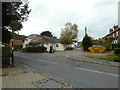
Pedestrians passing the parish hall in Church Street
Image: © Basher Eyre
Taken: 31 Oct 2011
0.10 miles
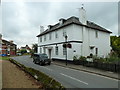
6
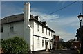
Former Vicarage, Fordingbridge
Opposite the church across the B3108, and described at https://www.historicengland.org.uk/listing/the-list/list-entry/1166545 .
Image: © Derek Harper
Taken: 16 Jul 2016
0.10 miles
7
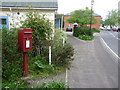
Fordingbridge: postbox № SP6 137, Church Street
This small postbox is set on an unusual red post, and is situated directly opposite the parish church.
Image: © Chris Downer
Taken: 18 May 2013
0.11 miles
9
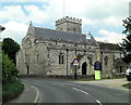
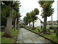
B3078 passes the Church of St Mary
This is a Grade I listed church originating in the 12th C. More work was done in the 13th and 15th C with the inevitable Victorian restoration by C. F. Ponting between 1901-3. It has English Heritage Building ID: 143947. Also see: http://www.britishlistedbuildings.co.uk/en-143947-church-of-st-mary-fordingbridge-hampshire
Image: © Stuart Logan
Taken: 4 Jun 2013
0.11 miles
10
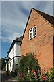
Buildings opposite the church, Fordingbridge
The white house is the former vicarage https://www.historicengland.org.uk/listing/the-list/list-entry/1166545 , shown in Image In the foreground is Mulberry Mews.
Image: © Derek Harper
Taken: 16 Jul 2016
0.11 miles