IMAGES TAKEN NEAR TO
Lower Road, SALISBURY, SP5 4DY
Introduction
This page details the photographs taken nearby to Lower Road, SP5 4DY by members of the Geograph project.
The Geograph project started in 2005 with the aim of publishing, organising and preserving representative images for every square kilometre of Great Britain, Ireland and the Isle of Man.

There are currently over 7.5m images from over14,400 individuals and you can help contribute to the project by visiting https://www.geograph.org.uk
Image Map
Images are licensed for reuse under creativecommons.org/licenses/by-sa/2.0
Notes
- Clicking on the map will re-center to the selected point.
- The higher the marker number, the further away the image location is from the centre of the postcode.
Image Listing (34 Images Found)
Images are licensed for reuse under creativecommons.org/licenses/by-sa/2.0
Image
Details
Distance
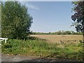
2
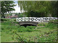
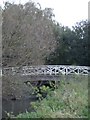
Britford - bridge at Bridge Farm
To the left of the bridge, across the fields, can be seen the tower of Britford Church. A view from this bridge is available at Image
Image: © Dave Bevis
Taken: 6 May 2009
0.01 miles
5
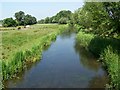
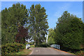
River Avon, Britford
The River Avon divides into several small waterways to irrigate the extensive water meadows around Britford. Looking upstream towards Salisbury.
Image: © Maigheach-gheal
Taken: 29 Jun 2009
0.02 miles
6
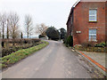
The Cheese House
The Cheese House stands on the roadside adjacent to Bridge Farm, unfortunately I cannot find any relevant information regarding the history of it; if anyone can enlighten me I would be grateful. There is an Ordnance Survey benchmark on the nearest corner, see Image
Image: © Jonathan Kington
Taken: 12 Feb 2012
0.02 miles
7
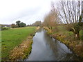
Britford, Avon Navigation
A complete section of the navigation, from Britford to Harnham; part of a C17 scheme to make the Avon navigable from Christchurch to Salisbury: http://www.whitenap.plus.com/local/avon_ind.htm
Image: © Mike Faherty
Taken: 14 Dec 2013
0.02 miles
8
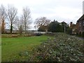
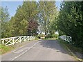
Britford, road bridge
Carrying Lower Road over Avon Navigation.
Image: © Mike Faherty
Taken: 14 Dec 2013
0.02 miles
9

View from the bridge at Bridge Farm
This is a navigation channel. You would think that 5 rivers were enough!
Image: © Toby
Taken: 11 Nov 2006
0.03 miles