IMAGES TAKEN NEAR TO
The Green, SALISBURY, SP5 4BY
Introduction
This page details the photographs taken nearby to The Green, SP5 4BY by members of the Geograph project.
The Geograph project started in 2005 with the aim of publishing, organising and preserving representative images for every square kilometre of Great Britain, Ireland and the Isle of Man.

There are currently over 7.5m images from over14,400 individuals and you can help contribute to the project by visiting https://www.geograph.org.uk
Image Map
Images are licensed for reuse under creativecommons.org/licenses/by-sa/2.0
Notes
- Clicking on the map will re-center to the selected point.
- The higher the marker number, the further away the image location is from the centre of the postcode.
Image Listing (150 Images Found)
Images are licensed for reuse under creativecommons.org/licenses/by-sa/2.0
Image
Details
Distance
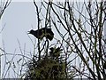
2
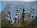
Rookery in the making, Bishopstone
Rooks nest in a colony called a rookery. The nest is built high in a tree close to other nests. The nest is bulky and made from twigs bound together with earth, lined with moss, leaves, grass, wool, hair, etc. The previous years' nests may be renovated and reused.
Image: © Maigheach-gheal
Taken: 4 Mar 2008
0.01 miles
3
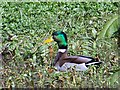
Mallard drake (Anas platyrhynchos)
It is the commonest duck and most widespread so you have a chance of seeing it just about anywhere where there is suitable wetland habitat, even in urban areas. This bird is in an area of unkept watercress bed.
Image: © Maigheach-gheal
Taken: 4 Mar 2008
0.01 miles
4
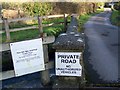
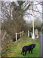
Your Sat-Nav is wrong, Bishopstone
Some unsuspecting people think they can get from Croucheston to Flamstone Street via the footpath and it is difficult to turn if you head down the drive which is most definitely private.
Image: © Maigheach-gheal
Taken: 24 Jan 2010
0.02 miles
5
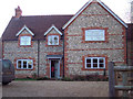
Little Bridge House
A modern build using brick and flint.
Image: © Maigheach-gheal
Taken: 16 Dec 2006
0.02 miles
6
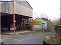
Croucheston Corn Mill
The front of the old mill where the road runs down to the River Ebble and the footpath to Flamstone Street.
Image: © Maigheach-gheal
Taken: 27 Dec 2006
0.02 miles
7
River Ebble at Croucheston
The River Ebble with "very" private drive and footpath.
Image: © Maigheach-gheal
Taken: 27 Dec 2006
0.02 miles
8
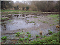
Former Watercress Bed
Left for nature to reclaim making a wonderful wildlife habitat.
Image: © Maigheach-gheal
Taken: 27 Dec 2006
0.02 miles
9
Use the Footpath
Please don't walk on the drive "its private".
Image: © Maigheach-gheal
Taken: 27 Dec 2006
0.02 miles
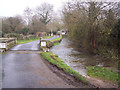
10
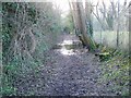
Footpath to Croucheston
At this time of the year the footpath always floods in this particular area. There is a way past by squeezing between the fence and the trees.
Image: © Maigheach-gheal
Taken: 24 Jan 2010
0.03 miles