
IMAGES TAKEN NEAR TO
Pitts Lane, SALISBURY, SP5 4AQ
Introduction
This page details the photographs taken nearby to Pitts Lane, SP5 4AQ by members of the Geograph project.
The Geograph project started in 2005 with the aim of publishing, organising and preserving representative images for every square kilometre of Great Britain, Ireland and the Isle of Man.

There are currently over 7.5m images from over14,400 individuals and you can help contribute to the project by visiting https://www.geograph.org.uk
Image Map
Images are licensed for reuse under creativecommons.org/licenses/by-sa/2.0
Notes
- Clicking on the map will re-center to the selected point.
- The higher the marker number, the further away the image location is from the centre of the postcode.
Image Listing (150 Images Found)
Images are licensed for reuse under creativecommons.org/licenses/by-sa/2.0
Image
Details
Distance
1
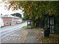
Bishopstone: bus lay-by and the Old Bakehouse
The old bakery is the corner building most prominent in the picture – recognisably a former shop.
Image: © Chris Downer
Taken: 1 Nov 2008
0.01 miles
2
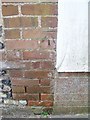
Bench Mark, Bishopstone
The mark is to be found on the northwest wall of Post Office Cottage. http://www.bench-marks.org.uk/bm33551
A bench mark is an Ordnance Survey arrowhead sign found on walls, bridges, churches and specially erected concrete posts where the altitude above sea-level has been accurately measured by surveyors. The arrowhead points to a horizontal line above it which marks the exact altitude.
Image: © Maigheach-gheal
Taken: 18 Mar 2010
0.02 miles
3
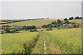
View of Bishopstone from footpath on Faulston Down
The part of Bishopstone to the right of the path line is unfortunately called The Pitts.
Image: © Peter Facey
Taken: 4 Jul 2006
0.03 miles
4
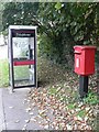
Bishopstone: postbox № SP5 316 and phone
A postbox of modern design stands alongside a phone box at a bus lay-by in Bishopstone. It is emptied finally at 5:15pm on weekdays, 8:45am on Saturdays. See also Image
Image: © Chris Downer
Taken: 1 Nov 2008
0.03 miles
5
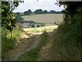
View, Bishopstone
Looking through the gap in the hedge from the footpath and bridleway junction at Faulston towards Whitlock Rise.
Image: © Maigheach-gheal
Taken: 15 Sep 2009
0.03 miles
7
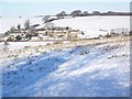
View across to Whitlocks
Looking across the snow covered fields to the small housing estate of Whitlocks Rise from the footpath/bridleway junction.
Image: © Maigheach-gheal
Taken: 7 Jan 2010
0.04 miles
8
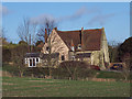
Old School House
Once the school in the village of Bishopstone taking children from the ages of 5 to 11 years. The school was founded by the Rev. George Augustus Montgomery in 1837. It closed circa 1980. I was a pupil at the school - far too long ago to say when.
Image: © Maigheach-gheal
Taken: 10 Jan 2007
0.05 miles
10
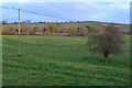
Field beside the road at Bishopstone
Looking across the Ebble Valley.
Image: © David Martin
Taken: 21 Mar 2015
0.06 miles