
IMAGES TAKEN NEAR TO
The Headlands, SALISBURY, SP5 3HJ
Introduction
This page details the photographs taken nearby to The Headlands, SP5 3HJ by members of the Geograph project.
The Geograph project started in 2005 with the aim of publishing, organising and preserving representative images for every square kilometre of Great Britain, Ireland and the Isle of Man.

There are currently over 7.5m images from over14,400 individuals and you can help contribute to the project by visiting https://www.geograph.org.uk
Image Map
Images are licensed for reuse under creativecommons.org/licenses/by-sa/2.0
Notes
- Clicking on the map will re-center to the selected point.
- The higher the marker number, the further away the image location is from the centre of the postcode.
Image Listing (66 Images Found)
Images are licensed for reuse under creativecommons.org/licenses/by-sa/2.0
Image
Details
Distance
1
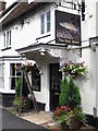
Funny looking bull
I always thought that a bull had horns. This one has fins.
There must be a story behind this,
Image: © william
Taken: 29 Aug 2010
0.01 miles
4
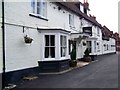
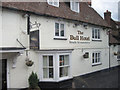
The Bull Inn, Downton
The Bull Inn is an early 18th century brick building that was a coaching inn and is very popular with anglers fishing on the River Avon.
Image: © Maigheach-gheal
Taken: 25 Apr 2010
0.02 miles
5
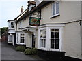
The Bull, Downton
One of four pubs in Downton, this one is on the main road between Salisbury and Fordingbridge.
Image: © Judith Green
Taken: 12 Mar 2007
0.02 miles
6
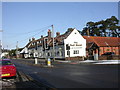
Downton, The Bull
Pub with carvery at the junction of Salisbury Road and The Borough. Cask ale on offer at my visit: Ringwood Best. For some customer comments, see http://www.beerintheevening.com/pubs/s/24/2407/Bull/Downton
Image: © Mike Faherty
Taken: 9 Jan 2010
0.03 miles
7
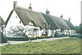
A row of thatched cottages, Downton in 1988
Situated beside The Borough
Image: © John Baker
Taken: 22 Apr 1988
0.03 miles
8
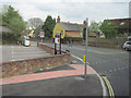
Junction of The Borough and A338 at Traffic Lights
Image: © John Firth
Taken: 10 May 2010
0.03 miles
10
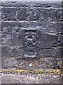
Flush Bracket S0365, The Bull Inn
Although heavily covered in black paint, the flush bracket is in good condition. For a view of the inn Image and http://www.bench-marks.org.uk/bm20428
A bench mark is an Ordnance Survey arrowhead sign found on walls, bridges, churches and specially erected triangulation pillars where the altitude above sea-level has been accurately measured by surveyors. The arrowhead points to a horizontal line above it which marks the exact altitude.
With rivets and pivots there is no datum (horizontal line) cut, the pointed-to horizontal surface defining the datum height.
Image: © Maigheach-gheal
Taken: 25 Apr 2010
0.03 miles