IMAGES TAKEN NEAR TO
St. Marys Close, SALISBURY, SP5 2PP

Introduction

This page details the photographs taken nearby to St. Marys Close, SP5 2PP by members of the Geograph project.

The Geograph project started in 2005 with the aim of publishing, organising and preserving representative images for every square kilometre of Great Britain, Ireland and the Isle of Man.

There are currently over 7.5m images from over14,400 individuals and you can help contribute to the project by visiting https://www.geograph.org.uk

Image Map


Images are licensed for reuse under creativecommons.org/licenses/by-sa/2.0
Notes
  • Clicking on the map will re-center to the selected point.
  • The higher the marker number, the further away the image location is from the centre of the postcode.

Image Listing (57 Images Found)

Images are licensed for reuse under creativecommons.org/licenses/by-sa/2.0
  • ...
Image
Details
Distance
1
Scarecrow, Lover
Just one of the entrants in the Morgan's Vale and Woodfalls Primary School's Springfest.
Image: © Maigheach-gheal Taken: 25 Apr 2010
0.04 miles
2
Weather vane, Lover
The word 'vane' comes from the Anglo-Saxon word 'fane', meaning 'flag'. Originally, fabric pennants would show archers the direction of the wind. Later, the cloth flags were replaced by metal ones, decorated with the nobleman's coat of arms. It was understood that shifts in the wind often indicated changes in the weather. Cardinal points were not added until several centuries later.
Image: © Maigheach-gheal Taken: 25 Apr 2010
0.04 miles
3
School Road, Lover
Image: © David Martin Taken: 15 Jun 2018
0.05 miles
4
Redlynch and Lover Primary School
Image: © Maigheach-gheal Taken: 6 Feb 2007
0.07 miles
5
Lover Post Box
This post box is outside the former post office, which was a converted household garage. It was well known around the world for stamping valentine cards with a special postmark: "St Valentine's Day Lover Salisbury", until 2008 when the post office was shut down.
Image: © Lorraine and Keith Bowdler Taken: 14 Feb 2010
0.08 miles
6
Scarecrow, Lover
Just one of the entrants in the Morgan's Vale and Woodfalls Primary School's Springfest.
Image: © Maigheach-gheal Taken: 25 Apr 2010
0.09 miles
7
Scarecrow, Lover
Just one of the entrants in the Morgan's Vale and Woodfalls Primary School's Springfest.
Image: © Maigheach-gheal Taken: 25 Apr 2010
0.10 miles
8
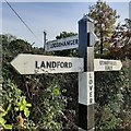
Direction Sign ? Signpost
Located in Lover on the southeast side of the junction of School Road and Loosehanger, Redlynch parish. 3 arms and pyramid top. See also https://www.geograph.org.uk/photo/1825704. Milestone Society National ID: WI_SU2019
Image: © Z La Gumina Taken: 28 Oct 2019
0.10 miles
9
Road junction, Lover
Finger post at the junction at Lover. For a close-up of the sign see Image
Image: © Maigheach-gheal Taken: 26 Apr 2010
0.11 miles
10
Finger post, Lover
The upright post has the inscription Lover.
Image: © Maigheach-gheal Taken: 26 Apr 2010
0.11 miles
  • ...