1
The Orange Way in Wiltshire (272)
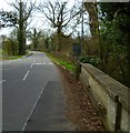
This is looking south on Netheravon High Street and here comes my bus.
To proceed to the next section of the Orange Way go to www.geograph.org.uk/geotrips/570.
Image: © Shazz
Taken: 24 Apr 2013
0.02 miles
2
The Orange Way in Wiltshire (271)
Here's a triangle of green between High Street and Lower Road in Netheravon.
Image: © Shazz
Taken: 24 Apr 2013
0.03 miles
3
Millennium Park, Netheravon: September 2024
Image: © Basher Eyre
Taken: 10 Sep 2024
0.07 miles
4
Stream beside Lower Road, Netheravon
Image: © David Martin
Taken: 12 Feb 2015
0.10 miles
5
Dog and Gun Fish and Chips. Netheravon
This photo was taken about a month after the pub had been taken over and it now seems to be operating like a fish and chip shop with beer! A different way indeed to revive the pub trade.
Image: © Nigel Mykura
Taken: 23 Jun 2013
0.11 miles
6
The Dog & Gun, Netheravon
On Salisbury Road.
Refurbished since 2013
Image]
Image: © JThomas
Taken: 13 Jul 2019
0.11 miles
7
Sign for the Dog & Gun, Netheravon
Image: © JThomas
Taken: 13 Jul 2019
0.11 miles
8
The Orange Way in Wiltshire (269)
This is yet another crossing of the River Avon on the way to Netheravon.
Image: © Shazz
Taken: 24 Apr 2013
0.11 miles
9
The Orange Way in Wiltshire (273)
This cottage on Netheravon High Street has a clock showing the right time.
Image: © Shazz
Taken: 25 Apr 2013
0.11 miles
10
Lych gate, All Saints Church, Netheravon
Many churches have a lych gate built over the main entrance to the enclosed area round the church. The name, also spelt lich or lytch, is from the Anglo Saxon 'lich' meaning corpse. The gate marks the division between consecrated and unconsecrated ground, where the bearers sheltered with the coffin, waiting for the clergyman to lead the procession before the burial.
Image: © Maigheach-gheal
Taken: 11 Mar 2007
0.11 miles


