IMAGES TAKEN NEAR TO
Stonehenge Road, SALISBURY, SP4 8BN
Introduction
This page details the photographs taken nearby to Stonehenge Road, SP4 8BN by members of the Geograph project.
The Geograph project started in 2005 with the aim of publishing, organising and preserving representative images for every square kilometre of Great Britain, Ireland and the Isle of Man.

There are currently over 7.5m images from over14,400 individuals and you can help contribute to the project by visiting https://www.geograph.org.uk
Image Map
Images are licensed for reuse under creativecommons.org/licenses/by-sa/2.0
Notes
- Clicking on the map will re-center to the selected point.
- The higher the marker number, the further away the image location is from the centre of the postcode.
Image Listing (10 Images Found)
Images are licensed for reuse under creativecommons.org/licenses/by-sa/2.0
Image
Details
Distance
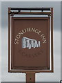
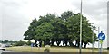
2

Sign for the Stonehenge Inn
The most important prehistoric monument in Britain. The stones are thought to have been erected about 3,500 years ago. Stonehenge takes its name from the stones which 'hang' between upright stones. The use of which Stonehenge was put is still something of a mystery, though it is probable that it was for some kind of sun-worship.
Image: © Maigheach-gheal
Taken: 12 Feb 2007
0.02 miles
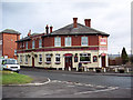
3
The Stonehenge Inn, Durrington
On Stonehenge Road.
Image: © JThomas
Taken: 13 Jul 2019
0.04 miles
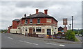
4
Sign for the Stonehenge Inn, Durrington
See Image] for context.
Image: © JThomas
Taken: 13 Jul 2019
0.05 miles
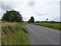
5
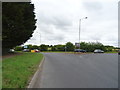
Larkhill Road, Durrington
The A3028 approaching roundabout on the A345.
Image: © JThomas
Taken: 13 Jul 2019
0.08 miles
7
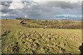
Durrington, Larkhill Road
Looking across Durrington Walls and the A345 to the houses on Larkhill Road, Durrington.
Image: © Cynthia Poole
Taken: 18 Mar 2023
0.15 miles
9
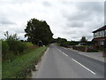
Netheravon Road (A345), Durrington
Towards Amesbury.
Image: © JThomas
Taken: 13 Jul 2019
0.24 miles
10
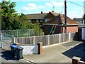
Electricity sub-station, Mead's Road, Durrington
Electricity sub-stations generally go unnoticed although they play a huge part in ensuring modern life can continue in the way we all take for granted. Although unglamorous, often sub-stations are housed in buildings that at least try to blend in with their residential neighbours, as in this case in south Wiltshire.
Image: © Brian Robert Marshall
Taken: 12 Apr 2011
0.24 miles