
IMAGES TAKEN NEAR TO
Millbrook Lane, SALISBURY, SP3 6AW
Introduction
This page details the photographs taken nearby to Millbrook Lane, SP3 6AW by members of the Geograph project.
The Geograph project started in 2005 with the aim of publishing, organising and preserving representative images for every square kilometre of Great Britain, Ireland and the Isle of Man.

There are currently over 7.5m images from over14,400 individuals and you can help contribute to the project by visiting https://www.geograph.org.uk
Image Map
Images are licensed for reuse under creativecommons.org/licenses/by-sa/2.0
Notes
- Clicking on the map will re-center to the selected point.
- The higher the marker number, the further away the image location is from the centre of the postcode.
Image Listing (68 Images Found)
Images are licensed for reuse under creativecommons.org/licenses/by-sa/2.0
Image
Details
Distance
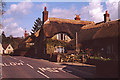
2
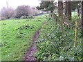
Footpath, East Knoyle
The footpath takes walkers from the church to the A350.
Image: © Maigheach-gheal
Taken: 16 Nov 2009
0.10 miles
4
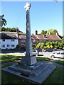
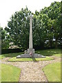
War Memorial, East Knoyle: late August 2016
Image: © Basher Eyre
Taken: 26 Aug 2016
0.11 miles
5
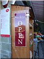
East Knoyle: shop sign
Inside is a notice alluding to their recent "Wrenovation"http://www.eastknoyle.org.uk/
(at least I'm not the only one)
Image: © Basher Eyre
Taken: 26 Aug 2016
0.11 miles
6
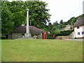
Village green, East Knoyle
A K6 type telephone box set against Wren's Store with the village war memorial.
Image: © Maigheach-gheal
Taken: 28 Jun 2009
0.12 miles
7
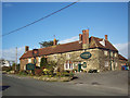
The Seymour Arms, East Knoyle
The inn is 17th century and is named after the Seymour family who once owned part of the village. Until recently, this historic building shook to the sound of traffic thundering by on the main A350 road at the front of the pub. However, the much needed East Knoyle bypass, completed in 1996, has restored peace and calm to the village.
East Knoyle is a large scattered village on a greensand ridge and is surrounded by some fine walking country. Christopher Wren, whose father was Rector of East Knoyle, was born in a room above the village shop in October 1632.
Image: © Maigheach-gheal
Taken: 9 Mar 2007
0.12 miles
9
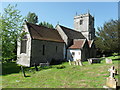
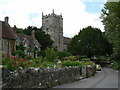
Church of St. Mary
East Knoyle was the birthplace of Sir Christopher Wren in 1632, where his father was then rector of the parish.
Image: © Kevin Farmer
Taken: 30 May 2009
0.14 miles
10
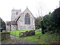
St Mary's Church, East Knoyle
The church has its origins in the 12th century and was restored in 1845 by Wyatt and Brandon and again in 1876 by Blomfield. The tower was restored in 1893 by P Webb. It is built of Rubble stone and dressed limestone.
Image: © Maigheach-gheal
Taken: 16 Nov 2009
0.14 miles