IMAGES TAKEN NEAR TO
High Street, SALISBURY, SP3 5QF
Introduction
This page details the photographs taken nearby to High Street, SP3 5QF by members of the Geograph project.
The Geograph project started in 2005 with the aim of publishing, organising and preserving representative images for every square kilometre of Great Britain, Ireland and the Isle of Man.

There are currently over 7.5m images from over14,400 individuals and you can help contribute to the project by visiting https://www.geograph.org.uk
Image Map
Images are licensed for reuse under creativecommons.org/licenses/by-sa/2.0
Notes
- Clicking on the map will re-center to the selected point.
- The higher the marker number, the further away the image location is from the centre of the postcode.
Image Listing (9 Images Found)
Images are licensed for reuse under creativecommons.org/licenses/by-sa/2.0
Image
Details
Distance
2
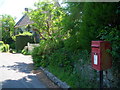
Ansty: postbox № SP3 12
The postbox is rather to the north of the village, and has been moved from the centre in recent years, judging by the very large scale maps which show it by the cottages close to the maypole.
Image: © Chris Downer
Taken: 8 Jun 2013
0.12 miles
3
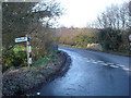
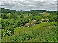
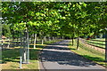
Junction of Yule Hill and High Street
That's Ansty High Street. There's a stream running under the bridge.
Image: © Toby
Taken: 3 Dec 2006
0.21 miles
6
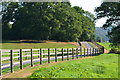
Entrance to Squalls Farm from King's Lane, Ansty
Image: © Maigheach-gheal
Taken: 10 Mar 2007
0.23 miles
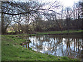
8
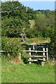
Stiles, footbridge and gate in Ansty Combe
Image: © David Martin
Taken: 12 Aug 2020
0.24 miles