
IMAGES TAKEN NEAR TO
Netherhampton Road, SALISBURY, SP2 8PX
Introduction
This page details the photographs taken nearby to Netherhampton Road, SP2 8PX by members of the Geograph project.
The Geograph project started in 2005 with the aim of publishing, organising and preserving representative images for every square kilometre of Great Britain, Ireland and the Isle of Man.

There are currently over 7.5m images from over14,400 individuals and you can help contribute to the project by visiting https://www.geograph.org.uk
Image Map
Images are licensed for reuse under creativecommons.org/licenses/by-sa/2.0
Notes
- Clicking on the map will re-center to the selected point.
- The higher the marker number, the further away the image location is from the centre of the postcode.
Image Listing (42 Images Found)
Images are licensed for reuse under creativecommons.org/licenses/by-sa/2.0
Image
Details
Distance
1
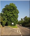
Junction at Netherhampton
A wooded triangle lies between these roads; the A3094 Netherhampton Road is on the right. 100 metres ahead, the A3094 meets The Strip and turns sharp right; the road to the left likewise meets The Strip at a T junction.
Image: © Derek Harper
Taken: 21 Jun 2014
0.05 miles
2
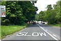
A3094 at Netherhampton Corner
The A3094 turns sharp right.
Image: © Robin Webster
Taken: 10 Jun 2018
0.09 miles
3
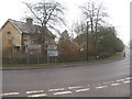
Road signs at the junction of The Strip and Netherhampton Road
Image: © Rod Allday
Taken: 7 Mar 2013
0.09 miles
4
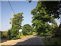
Roadside trees, Netherhampton
The short stretch of road between the main part of the village and the western junction with the A3094.
Image: © Derek Harper
Taken: 21 Jun 2014
0.11 miles
5
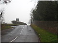
The Strip Netherhampton
A long straight minor road running alongside the grounds of Wilton Park, on the right of the photo.
Image: © Rod Allday
Taken: 7 Mar 2013
0.11 miles

7
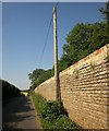
Wall bounding Wilton Park
Also shown in Image; this is taken further up the hill. The road leads to Stratford Tony, and is followed by the parish boundary between Wilton (right) and Netherhampton.
Image: © Derek Harper
Taken: 21 Jun 2014
0.13 miles
8
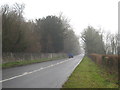
The A3094 Netherhampton Road
The wall on the left encloses Wilton Park.
Image: © Rod Allday
Taken: 7 Mar 2013
0.15 miles
9

St Catherine's Church, Netherhampton
The tower dates from the 18th century and is of brick with ashlar quoins.
Image: © Maigheach-gheal
Taken: 1 Feb 2007
0.16 miles
10

St Catherine's Church, Netherhampton
The church was rebuilt in 1876-7 by William Butterfield. It is built of limestone and flint chequers. The tower dates from the 18th century.
Image: © Maigheach-gheal
Taken: 1 Feb 2007
0.17 miles