
IMAGES TAKEN NEAR TO
Jones Close, SALISBURY, SP2 0FJ
Introduction
This page details the photographs taken nearby to Jones Close, SP2 0FJ by members of the Geograph project.
The Geograph project started in 2005 with the aim of publishing, organising and preserving representative images for every square kilometre of Great Britain, Ireland and the Isle of Man.

There are currently over 7.5m images from over14,400 individuals and you can help contribute to the project by visiting https://www.geograph.org.uk
Image Map
Images are licensed for reuse under creativecommons.org/licenses/by-sa/2.0
Notes
- Clicking on the map will re-center to the selected point.
- The higher the marker number, the further away the image location is from the centre of the postcode.
Image Listing (15 Images Found)
Images are licensed for reuse under creativecommons.org/licenses/by-sa/2.0
Image
Details
Distance
1
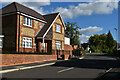
House on the corner of Oakley Road
Modern development which has borrowed many 1930s themes in the house designs.
Image: © David Martin
Taken: 8 Oct 2022
0.03 miles
2
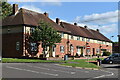
Houses in Thornton Crescent
These houses appear to have been just outside the adjacent former Erskine Barracks site, that has been redeveloped as housing since 2013.
Image: © David Martin
Taken: 8 Oct 2022
0.09 miles
3
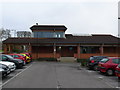
Salisbury Park and Ride
This is the main building of the park and ride which houses the waiting room and toilets. It is surrounded by car parking spaces. The buses pull up on the opposite side of this building. At time of photo the cost of a ride into Salisbury was £2.50 for a single person and £3.50 for a group of four people in a car.
Image: © Nigel Mykura
Taken: 4 Jan 2013
0.13 miles
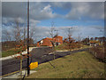
5
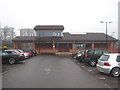
The terminus building at Salisbury Park & Ride at Wilton
Image: © Rod Allday
Taken: 7 Mar 2013
0.14 miles
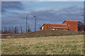
8
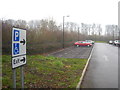
Sign at Salisbury Park & Ride at Wilton
The north corner of the car park is in this grid square.
Image: © Rod Allday
Taken: 7 Mar 2013
0.16 miles
9
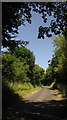
Kingsway, Wilton
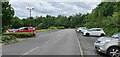
Behind the trees on the right is the Salisbury Park and Ride http://www.geograph.org.uk/gridref/SU1031?centi=SU102319 .
Image: © Derek Harper
Taken: 30 Jun 2018
0.17 miles
10
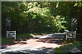
Heading out of town on The Avenue
Fences and national speed limit signs mark the northern end of the residential area at Fuggleston St Peter.
Image: © David Martin
Taken: 8 Oct 2022
0.18 miles