1
Ludgershall: Castle Mews, Crown Lane
I think that the writing on the wall of this building says "Furniture Depository", implying that it might have been a forerunner of all those modern self-storage buildings, but particularly built to suit the needs of military personnel passing through. Whatever, the Sky satellite dishes show that it has been converted into residential properties.
Image: © Nigel Cox
Taken: 12 Jul 2009
0.02 miles
2
Keep Cottage, Castle Street, Ludgershall
Near the corner - where the road turns westward and becomes Butt Street. In the Wiltshire volume of 'The Buildings of England', Pevsner suggests that this row of cottages may have been almshouses - and draws attention to the pilasters (columns in low-relief) which, he thinks, could indicate a late 17th-century origin.
What is clear is that over the centuries the structure has been patched up many a time. Notice the blocked doorway on the left - which would suggest that two tiny dwellings (almshouses?) have been knocked into one.
Image: © Stefan Czapski
Taken: 6 Jun 2015
0.03 miles
3
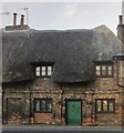
Ludgershall - Cottages In Castle Street
These cottages are on the edge of Ludgershall.
Image: © Chris Talbot
Taken: 19 May 2008
0.03 miles
4
Castle Street, Ludgershall
This Photo is showing the Junction of Castle Street, Deweys Lane and High Street Ludgershall, on the A342.
Image: © Donna Pearce
Taken: 26 Jun 2008
0.03 miles
5
A342 at bend at Ludgershall
Right angled bend into Ludgershall
Image: © John Firth
Taken: 31 Mar 2014
0.03 miles
6
Ludgershall - Repository Housing
This former repository has been converted into housing.
Image: © Chris Talbot
Taken: 19 Mar 2011
0.03 miles
7
Flint rubble wall, Butt Street, Ludgershall
Running along the north side of Butt Street at its eastern end. Photo taken from Castle Street.
Image: © Stefan Czapski
Taken: 6 Jun 2015
0.03 miles
8
Ludgershall: Old Castle Club
The Old Castle Club is at the north end of Castle Street.
Image: © Nigel Cox
Taken: 12 Jul 2009
0.03 miles
9
Castle Street
Image: © John Baker
Taken: 27 Mar 2015
0.03 miles
10
Old Castle Club and thatched houses
Image: © Oast House Archive
Taken: 1 Sep 2017
0.04 miles


