IMAGES TAKEN NEAR TO
Upper Chute, ANDOVER, SP11 9EX

Introduction

This page details the photographs taken nearby to SP11 9EX by members of the Geograph project.

The Geograph project started in 2005 with the aim of publishing, organising and preserving representative images for every square kilometre of Great Britain, Ireland and the Isle of Man.

There are currently over 7.5m images from over14,400 individuals and you can help contribute to the project by visiting https://www.geograph.org.uk

Image Map


Images are licensed for reuse under creativecommons.org/licenses/by-sa/2.0
Notes
  • Clicking on the map will re-center to the selected point.
  • The higher the marker number, the further away the image location is from the centre of the postcode.

Image Listing (13 Images Found)

Images are licensed for reuse under creativecommons.org/licenses/by-sa/2.0
Image
Details
Distance
1
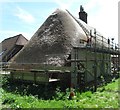
Finishing touches
A group of thatchers working on a cottage at Scot's Poor. The thatching has been done using straw from Devonshire, whilst there's just the protective netting to fix. This looks like another of those 'gentrification' examples in this part of the world, which seems to be creeping ever closer to London.
Image: © Gordon Hatton Taken: 22 May 2017
0.01 miles
2
Farmland, Scot's Poor
Looking west alongside a public footpath towards Scotspoor Plantation.
Image: © Andrew Smith Taken: 9 Feb 2008
0.02 miles
3
Cottage restoration at Scot's Poor
This is an intriguing name being applied to a wood and a plantation as well as the curtilage of this cottage. Also on the site is a chapel like building??
Image: © Stuart Logan Taken: 26 Jul 2011
0.02 miles
4
Chute Causeway at Scot's Poor
Looking south-eastward.
Image: © Peter Wood Taken: 17 Feb 2017
0.02 miles
5
Junction with byway on Chute Causeway
Chute Causeway is a Roman Road that is different! It's not straight; or rather it is a curve formed by 9 short straight sections that follow the contour line around Hippenscombe, a steep dry valley. The road goes from Winchester to Mildenhall. Here it crosses a pre-Roman earthwork and is abutted by two PRoWs. See http://history.wiltshire.gov.uk/community/getconcise.php?id=60 for further details.
Image: © Stuart Logan Taken: 26 Jul 2011
0.02 miles
6
Snowdrops, Scot's Poor
Beside the bridleway that climbs through the southern edge of Scotspoor Plantation.
Image: © Andrew Smith Taken: 9 Feb 2008
0.05 miles
7
Country lane, Scot's Poor, Wiltshire
Image: © Oswald Bertram Taken: 18 Apr 2015
0.06 miles
8
Footpath at Scot's Poor
Image: © David Martin Taken: 28 Aug 2019
0.08 miles
9
Farmland, Scot's Poor
A view over stubble to the winding valley of Hippenscombe Bottom.
Image: © Andrew Smith Taken: 9 Feb 2008
0.12 miles
10
Chute Causeway
Looking south-eastward.
Image: © Peter Wood Taken: 17 Feb 2017
0.18 miles