IMAGES TAKEN NEAR TO
Mortimer Close, ANDOVER, SP11 6UW

Introduction

This page details the photographs taken nearby to Mortimer Close, SP11 6UW by members of the Geograph project.

The Geograph project started in 2005 with the aim of publishing, organising and preserving representative images for every square kilometre of Great Britain, Ireland and the Isle of Man.

There are currently over 7.5m images from over14,400 individuals and you can help contribute to the project by visiting https://www.geograph.org.uk

Image Map


Images are licensed for reuse under creativecommons.org/licenses/by-sa/2.0
Notes
  • Clicking on the map will re-center to the selected point.
  • The higher the marker number, the further away the image location is from the centre of the postcode.

Image Listing (20 Images Found)

Images are licensed for reuse under creativecommons.org/licenses/by-sa/2.0
Image
Details
Distance
1
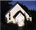
Church or chapel without either. Picket Piece, Andover
There was no sign outside to indicate the denomination or any other information.
Image: © Charles Greenhough Taken: 15 Apr 2007
0.15 miles
2
Locksbridge Road
Looking east along Locksbridge Road in the new housing estate.
Image: © Oscar Taylor Taken: 7 Mar 2023
0.16 miles
3
Picket Piece United Reformed Chapel
Wooden structure.
Image: © Michael FORD Taken: Unknown
0.16 miles
4
Lapstone Crescent
A road off Locksbridge Road.
Image: © Oscar Taylor Taken: 7 Mar 2023
0.18 miles
5
Broken steps to recreation ground
Broken steps being overgrown with weeds on the path up to the recreation ground at Picket Piece.
Image: © Oscar Taylor Taken: 7 Mar 2023
0.19 miles
6
Locksbridge Road
Looking east along Locksbridge Road past the car park for the playground.
Image: © Oscar Taylor Taken: 7 Mar 2023
0.20 miles
7
Picket Piece playground
A playground off Locksbridge Road in Picket Piece.
Image: © Oscar Taylor Taken: 7 Mar 2023
0.20 miles
8
Picket Piece playground
The playground and tennis court at Picket Piece.
Image: © Oscar Taylor Taken: 7 Mar 2023
0.20 miles
9
Pasture north of Ox Drove
Note the yellow tone of the grass after the cold winter of 2010.
Image: © Jonathan Billinger Taken: 16 Feb 2010
0.21 miles
10
Locksbridge Road
Looking west along Locksbridge Road in the new housing estate, towards The Dormouse.
Image: © Oscar Taylor Taken: 7 Mar 2023
0.21 miles