IMAGES TAKEN NEAR TO
SO5 3LF
Introduction
This page details the photographs taken nearby to SO5 3LF by members of the Geograph project.
The Geograph project started in 2005 with the aim of publishing, organising and preserving representative images for every square kilometre of Great Britain, Ireland and the Isle of Man.

There are currently over 7.5m images from over14,400 individuals and you can help contribute to the project by visiting https://www.geograph.org.uk
Image Map
Images are licensed for reuse under creativecommons.org/licenses/by-sa/2.0
Notes
- Clicking on the map will re-center to the selected point.
- The higher the marker number, the further away the image location is from the centre of the postcode.
Image Listing (52 Images Found)
Images are licensed for reuse under creativecommons.org/licenses/by-sa/2.0
Image
Details
Distance
1
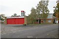
Eastleigh fire station
Eastleigh fire station, Steele Close, Chandler's Ford, Eastleigh, Hampshire in addition to being a fire station, serves as the training school for the brigade.
Image: © Kevin Hale
Taken: 11 Nov 2006
0.06 miles
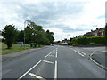
2
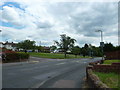
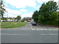
Approaching the junction of Raven Square and Nightingale Avenue
Image: © Basher Eyre
Taken: 1 Jul 2011
0.08 miles
3
Looking from Nightingale Avenue into Woodpecker Way (western end)
Image: © Basher Eyre
Taken: 1 Jul 2011
0.08 miles
4
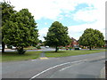
Green between Blackbird Road and Nightingale Avenue
Image: © Basher Eyre
Taken: 1 Jul 2011
0.10 miles
6
Looking from Nightingale Avenue into Raven Square
Image: © Basher Eyre
Taken: 1 Jul 2011
0.11 miles
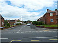
7
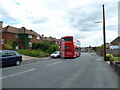
Bus heading eastwards in Nightingale Avenue
Image: © Basher Eyre
Taken: 1 Jul 2011
0.11 miles
8
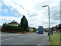
Bus heading westwards in Nightingale Avenue
Image: © Basher Eyre
Taken: 1 Jul 2011
0.11 miles
9
Approaching the junction of Jackdaw Rise and Nightingale Avenue
Image: © Basher Eyre
Taken: 1 Jul 2011
0.12 miles
10
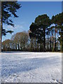
Snow on the old golf course
This used to be part of Eastleigh's golf course but this has now been reclaimed for public use and provides a green space for playing, exercising and dog walking...and sledging.
Image: © Eleanor Oakley
Taken: 7 Jan 2010
0.12 miles