IMAGES TAKEN NEAR TO
Augustus Way, EASTLEIGH, SO53 2BD
Introduction
This page details the photographs taken nearby to Augustus Way, SO53 2BD by members of the Geograph project.
The Geograph project started in 2005 with the aim of publishing, organising and preserving representative images for every square kilometre of Great Britain, Ireland and the Isle of Man.

There are currently over 7.5m images from over14,400 individuals and you can help contribute to the project by visiting https://www.geograph.org.uk
Image Map
Images are licensed for reuse under creativecommons.org/licenses/by-sa/2.0
Notes
- Clicking on the map will re-center to the selected point.
- The higher the marker number, the further away the image location is from the centre of the postcode.
Image Listing (66 Images Found)
Images are licensed for reuse under creativecommons.org/licenses/by-sa/2.0
Image
Details
Distance
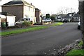
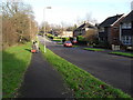
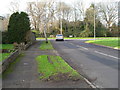
4
Looking from Alexandra Road into Scantabout Avenue
Image: © Basher Eyre
Taken: 12 Dec 2009
0.04 miles
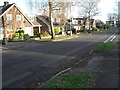
6
Looking along Corinthian Way towards the junction with Augustus Way
Image: © Basher Eyre
Taken: 12 Dec 2009
0.04 miles
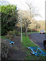
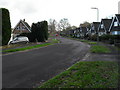
7
Boundary of Scantabout Avenue and Corinthian Road
Image: © Basher Eyre
Taken: 12 Dec 2009
0.04 miles
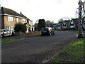
8
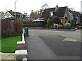
Looking from Scantabout Avenue towards Augustus Way
Image: © Basher Eyre
Taken: 12 Dec 2009
0.05 miles
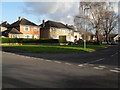
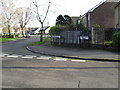
9
Approaching the junction of Scantabout Avenue and Corinthian Road
Image: © Basher Eyre
Taken: 12 Dec 2009
0.06 miles
10
Approaching the junction of Corinthian Road and Vesta Way
Image: © Basher Eyre
Taken: 12 Dec 2009
0.06 miles