IMAGES TAKEN NEAR TO
Beedon Way, EASTLEIGH, SO50 9RW
Introduction
This page details the photographs taken nearby to Beedon Way, SO50 9RW by members of the Geograph project.
The Geograph project started in 2005 with the aim of publishing, organising and preserving representative images for every square kilometre of Great Britain, Ireland and the Isle of Man.

There are currently over 7.5m images from over14,400 individuals and you can help contribute to the project by visiting https://www.geograph.org.uk
Image Map
Images are licensed for reuse under creativecommons.org/licenses/by-sa/2.0
Notes
- Clicking on the map will re-center to the selected point.
- The higher the marker number, the further away the image location is from the centre of the postcode.
Image Listing (31 Images Found)
Images are licensed for reuse under creativecommons.org/licenses/by-sa/2.0
Image
Details
Distance
1
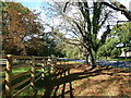
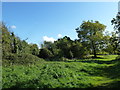
Path from Park Farm arriving at Chestnut Avenue
Image: © Basher Eyre
Taken: 20 Oct 2011
0.15 miles
2
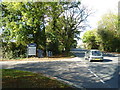
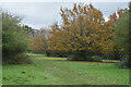
Car passing the turning for the Golf Driving Range in Chestnut Avenue
Image: © Basher Eyre
Taken: 20 Oct 2011
0.15 miles
3
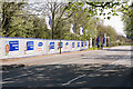
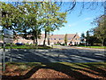
Entrance to Chestnut Park housing development
The road is Chestnut Avenue. The turning on the left where the pedestrians are is a new road named Sandmartin Close. There are people living there but, naturally, the Royal Mail postcode finder knows nothing about the Close. In the long run, these things become irritating.
Image: © Peter Facey
Taken: 5 Apr 2009
0.16 miles
7
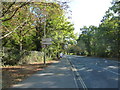
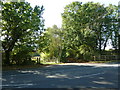
Looking across Chestnut Avenue towards Sandmartin Close
Image: © Basher Eyre
Taken: 20 Oct 2011
0.17 miles
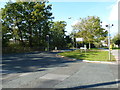
8
Looking across Chestnut Avenue towards a barrier
Image: © Basher Eyre
Taken: 20 Oct 2011
0.18 miles
9

Sandmartin Close
The road in the foreground is Chestnut Avenue whilst the new housing is on Sandmartin Close. Chestnut Park, a new housing development by Bryant. The notice says that it is "a development of 8 houses for rent and 2 houses for sale on a part buy/part rent basis by Thames Valley Housing Association". I think, however, that Chestnut Park also includes 2, 3 and 4 bedroomed homes for sale in the normal way. At time of photographing it was sold out.
(Coordinates estimated due to lack of OS mapping)
Image: © Peter Facey
Taken: 5 Apr 2009
0.18 miles
10
Junction of Chestnut and Nightingale Avenues
Image: © Basher Eyre
Taken: 20 Oct 2011
0.18 miles