IMAGES TAKEN NEAR TO
Gannaway Road, EASTLEIGH, SO50 9RN
Introduction
This page details the photographs taken nearby to Gannaway Road, SO50 9RN by members of the Geograph project.
The Geograph project started in 2005 with the aim of publishing, organising and preserving representative images for every square kilometre of Great Britain, Ireland and the Isle of Man.

There are currently over 7.5m images from over14,400 individuals and you can help contribute to the project by visiting https://www.geograph.org.uk
Image Map
Images are licensed for reuse under creativecommons.org/licenses/by-sa/2.0
Notes
- Clicking on the map will re-center to the selected point.
- The higher the marker number, the further away the image location is from the centre of the postcode.
Image Listing (36 Images Found)
Images are licensed for reuse under creativecommons.org/licenses/by-sa/2.0
Image
Details
Distance
1
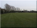
Playing fields off Chestnut Avenue
Playing fields off Chestnut Avenue on the Southern edge of Eastleigh
Image: © Shaun Ferguson
Taken: 29 Feb 2008
0.03 miles
2
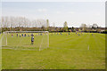
Playing Field south of Chestnut Avenue
I'm not clear what the name of this field is; neither is the map.
Image: © Peter Facey
Taken: 5 Apr 2009
0.04 miles
3
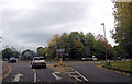
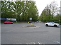
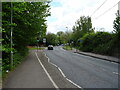
Roundabout at Stoneham Lane
From Chestnut Avenue
Image: © John Firth
Taken: 22 Oct 2015
0.04 miles
5
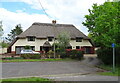
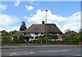
Thatched cottages off Stoneham Lane, Eastleigh
Image: © JThomas
Taken: 25 Apr 2022
0.06 miles
8
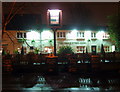
The Cricketers Arms
Warm lights on a wet winter night.
Image: © Robin Baker
Taken: 28 Jan 2009
0.08 miles
9
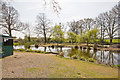
Eastleigh & District Angling Club private fishing pond
There are two small islands in the pond.
Image: © Peter Facey
Taken: 5 Apr 2009
0.11 miles
10
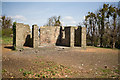
Stoneham War Shrine
After removal of surrounding Beech trees. For a similar view before the felling, see Image The substantial trees shown in that earlier photo were originally a hedge around the shrine, which was built in 1917. At some point, clipping of the hedge was abandoned. For much more on this shrine, including many photos at different dates, see http://www.northstoneham.org.uk/warshrine/index.html .
Image: © Peter Facey
Taken: 5 Apr 2009
0.12 miles