IMAGES TAKEN NEAR TO
Barton Road, EASTLEIGH, SO50 6RN
Introduction
This page details the photographs taken nearby to Barton Road, SO50 6RN by members of the Geograph project.
The Geograph project started in 2005 with the aim of publishing, organising and preserving representative images for every square kilometre of Great Britain, Ireland and the Isle of Man.

There are currently over 7.5m images from over14,400 individuals and you can help contribute to the project by visiting https://www.geograph.org.uk
Image Map
Images are licensed for reuse under creativecommons.org/licenses/by-sa/2.0
Notes
- Clicking on the map will re-center to the selected point.
- The higher the marker number, the further away the image location is from the centre of the postcode.
Image Listing (219 Images Found)
Images are licensed for reuse under creativecommons.org/licenses/by-sa/2.0
Image
Details
Distance
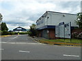
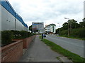
3
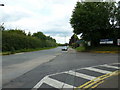
Looking from Chickenhall Lane towards Barton Road
Image: © Basher Eyre
Taken: 23 Jul 2011
0.03 miles
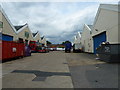
7
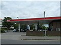
The Esso Garage- as seen from Bartons Road
Image: © Basher Eyre
Taken: 23 Jul 2011
0.05 miles
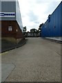
8
Bartons Park in July (4)
Looking down to Chickenhall Lane.
Image: © Basher Eyre
Taken: 23 Jul 2011
0.05 miles
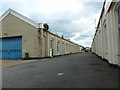
9
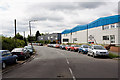
Chickenhall Lane with Barton Farm industrial estate on right
This lane affords access to several industrial estates and also to Eastleigh sewage works.
Image: © Peter Facey
Taken: 26 Jun 2007
0.05 miles
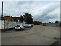
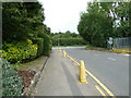
10
Junction of Bartons Park and Chickenhall Lane
Image: © Basher Eyre
Taken: 23 Jul 2011
0.05 miles