IMAGES TAKEN NEAR TO
Cranbury Road, EASTLEIGH, SO50 5HD
Introduction
This page details the photographs taken nearby to Cranbury Road, SO50 5HD by members of the Geograph project.
The Geograph project started in 2005 with the aim of publishing, organising and preserving representative images for every square kilometre of Great Britain, Ireland and the Isle of Man.

There are currently over 7.5m images from over14,400 individuals and you can help contribute to the project by visiting https://www.geograph.org.uk
Image Map
Images are licensed for reuse under creativecommons.org/licenses/by-sa/2.0
Notes
- Clicking on the map will re-center to the selected point.
- The higher the marker number, the further away the image location is from the centre of the postcode.
Image Listing (222 Images Found)
Images are licensed for reuse under creativecommons.org/licenses/by-sa/2.0
Image
Details
Distance
1
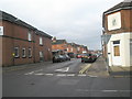
Crossroads of Desborough and Blenheim Roads
Image: © Basher Eyre
Taken: 12 Dec 2009
0.04 miles
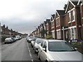
2
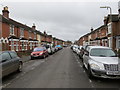
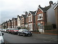
Desborough Road in Eastleigh
Looking southward.
Image: © Peter Wood
Taken: 26 Feb 2017
0.05 miles
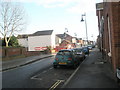
3
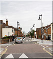
Traffic calming in Factory Road, Eastleigh
Image: © Peter Facey
Taken: 26 Jun 2007
0.05 miles
4
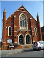
Baptist chapel in Desborough Road
This was built in 1903.
Image: © Shazz
Taken: 4 Mar 2013
0.05 miles
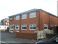
10
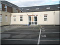
Tourist information centre in Chamberlayne Road
Image: © Basher Eyre
Taken: 12 Dec 2009
0.06 miles