IMAGES TAKEN NEAR TO
Totnes Close, EASTLEIGH, SO50 4QW
Introduction
This page details the photographs taken nearby to Totnes Close, SO50 4QW by members of the Geograph project.
The Geograph project started in 2005 with the aim of publishing, organising and preserving representative images for every square kilometre of Great Britain, Ireland and the Isle of Man.

There are currently over 7.5m images from over14,400 individuals and you can help contribute to the project by visiting https://www.geograph.org.uk
Image Map
Images are licensed for reuse under creativecommons.org/licenses/by-sa/2.0
Notes
- Clicking on the map will re-center to the selected point.
- The higher the marker number, the further away the image location is from the centre of the postcode.
Image Listing (67 Images Found)
Images are licensed for reuse under creativecommons.org/licenses/by-sa/2.0
Image
Details
Distance
1
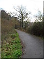
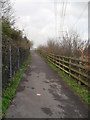
Following the pedestrian path from Fryern Hill to Eastleigh town centre (3)
Image: © Basher Eyre
Taken: 12 Dec 2009
0.05 miles
2
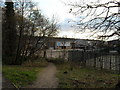
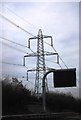
Industrial units as seen on path from M3 bridge to Boyatt Wood
Image: © Basher Eyre
Taken: 12 Dec 2009
0.05 miles
3
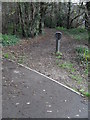
Following the pedestrian path from Fryern Hill to Eastleigh town centre (4)
Image: © Basher Eyre
Taken: 12 Dec 2009
0.05 miles
4
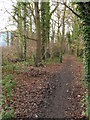
Following the pedestrian path from Fryern Hill to Eastleigh town centre (5)
Image: © Basher Eyre
Taken: 12 Dec 2009
0.05 miles
6
Following the pedestrian path from Fryern Hill to Eastleigh town centre (1)
Image: © Basher Eyre
Taken: 12 Dec 2009
0.06 miles
7
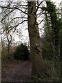
Squirrels in tree on path from the M3 bridge to Boyatts Wood
Image: © Basher Eyre
Taken: 12 Dec 2009
0.07 miles
8
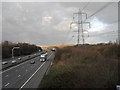
Looking northwards from the M3 footbridge between Fryern Hill and Boyatt Wood
Image: © Basher Eyre
Taken: 12 Dec 2009
0.07 miles
9
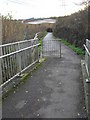
Path up to the bridge over the M3 between Boyatt Wood and Fryern Hill
Image: © Basher Eyre
Taken: 12 Dec 2009
0.07 miles
10
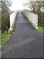
Bridge over the M3 between Westmorland Way and Exeter Close
Image: © Basher Eyre
Taken: 12 Dec 2009
0.08 miles