IMAGES TAKEN NEAR TO
Loughwood Close, EASTLEIGH, SO50 4QL
Introduction
This page details the photographs taken nearby to Loughwood Close, SO50 4QL by members of the Geograph project.
The Geograph project started in 2005 with the aim of publishing, organising and preserving representative images for every square kilometre of Great Britain, Ireland and the Isle of Man.

There are currently over 7.5m images from over14,400 individuals and you can help contribute to the project by visiting https://www.geograph.org.uk
Image Map
Images are licensed for reuse under creativecommons.org/licenses/by-sa/2.0
Notes
- Clicking on the map will re-center to the selected point.
- The higher the marker number, the further away the image location is from the centre of the postcode.
Image Listing (127 Images Found)
Images are licensed for reuse under creativecommons.org/licenses/by-sa/2.0
Image
Details
Distance
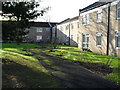
1
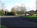
Looking from Loughwood Close into Broadlands Avenue
Image: © Basher Eyre
Taken: 12 Dec 2009
0.04 miles
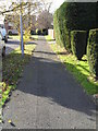
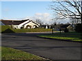
3
Path between Loughwood Close and Mountbatten Road
Image: © Basher Eyre
Taken: 12 Dec 2009
0.05 miles
4
Looking from Raglan Court towards Mountbatten Road
Image: © Basher Eyre
Taken: 12 Dec 2009
0.06 miles
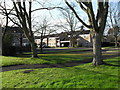
5
Raglan Court
Taken from Broadlands Avenue.
Image: © Basher Eyre
Taken: 12 Dec 2009
0.06 miles
7
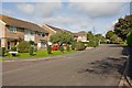
Broadlands Avenue
With Loughwood Close on the left.
Image: © Peter Facey
Taken: 13 Sep 2008
0.07 miles
8
Broadlands Avenue
With Chatsworth Close on the right. The road names in this housing estate seem to be derived from the names of stately homes.
Image: © Peter Facey
Taken: 13 Sep 2008
0.07 miles
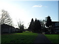
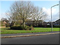
9
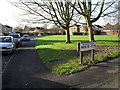
Green between Mountbatten Road and Broadlands Drive
Image: © Basher Eyre
Taken: 12 Dec 2009
0.08 miles
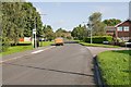
10
Looking from Arundel Road across Broadlands Avenue to Breamore Close
Image: © Basher Eyre
Taken: 12 Dec 2009
0.08 miles