IMAGES TAKEN NEAR TO
Ruskin Road, EASTLEIGH, SO50 4LE
Introduction
This page details the photographs taken nearby to Ruskin Road, SO50 4LE by members of the Geograph project.
The Geograph project started in 2005 with the aim of publishing, organising and preserving representative images for every square kilometre of Great Britain, Ireland and the Isle of Man.

There are currently over 7.5m images from over14,400 individuals and you can help contribute to the project by visiting https://www.geograph.org.uk
Image Map
Images are licensed for reuse under creativecommons.org/licenses/by-sa/2.0
Notes
- Clicking on the map will re-center to the selected point.
- The higher the marker number, the further away the image location is from the centre of the postcode.
Image Listing (84 Images Found)
Images are licensed for reuse under creativecommons.org/licenses/by-sa/2.0
Image
Details
Distance
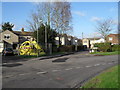
1
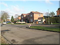
Approaching the junction of Ruskin Road and Lawn Road
Image: © Basher Eyre
Taken: 12 Dec 2009
0.01 miles
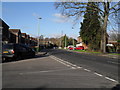
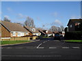
2
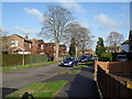
Looking north-east up Ruskin Road towards Twyford Road
Image: © Basher Eyre
Taken: 12 Dec 2009
0.01 miles
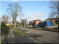
3
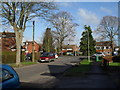
Approaching the junction of Ruskin Road and Twyford Road
Image: © Basher Eyre
Taken: 12 Dec 2009
0.01 miles
5
Looking towards the top end of Ruskin Road
Image: © Basher Eyre
Taken: 12 Dec 2009
0.03 miles
6
Looking from Ruskin Road into Twyford Road
Image: © Basher Eyre
Taken: 12 Dec 2009
0.03 miles
7
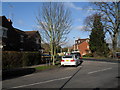
Junction of Ruskin Road and Twyford Road
Image: © Basher Eyre
Taken: 12 Dec 2009
0.03 miles
8
Looking from Twyford Road into Roseberry Close
Image: © Basher Eyre
Taken: 12 Dec 2009
0.06 miles
9
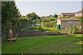
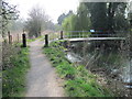
Allotment Gardens parallel to Ruskin Road
Run by Eastleigh Borough Council. Seen from path at their northern end. (Elevated camera position to see over fence)
Image: © Peter Facey
Taken: 13 Sep 2008
0.07 miles