IMAGES TAKEN NEAR TO
Furzedown Mews, SOUTHAMPTON, SO45 3GS
Introduction
This page details the photographs taken nearby to Furzedown Mews, SO45 3GS by members of the Geograph project.
The Geograph project started in 2005 with the aim of publishing, organising and preserving representative images for every square kilometre of Great Britain, Ireland and the Isle of Man.

There are currently over 7.5m images from over14,400 individuals and you can help contribute to the project by visiting https://www.geograph.org.uk
Image Map
Images are licensed for reuse under creativecommons.org/licenses/by-sa/2.0
Notes
- Clicking on the map will re-center to the selected point.
- The higher the marker number, the further away the image location is from the centre of the postcode.
Image Listing (22 Images Found)
Images are licensed for reuse under creativecommons.org/licenses/by-sa/2.0
Image
Details
Distance
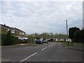
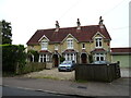
3
Frost Lane junction with Furzedale Park
Image: © Stuart Logan
Taken: 22 Aug 2012
0.06 miles
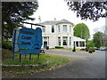
6
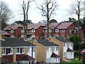
New Houses near the Fountain Court Hotel Hythe
More houses are squeezed in on this 1970's housing estate.
Image: © Gillian Thomas
Taken: 28 Jan 2007
0.14 miles
7
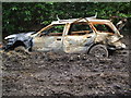
Abandoned Car on the Solent Way at Hythe
Never to move again!
Image: © Gillian Thomas
Taken: 28 Mar 2007
0.15 miles
8
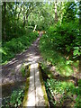
The Solent Way (137)
Look here (http://www.geograph.org.uk/photo/381101 ) to see the change since 2007, although this photo is in the opposite direction
Image: © Shazz
Taken: 31 Aug 2012
0.15 miles
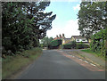
9
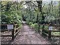
Pinch point on Hart Hill
A pinch point on Hart Hill, intended to discourage motor vehicles from proceeding south along the unsealed part of the road south of the Travellers' Rest public house. This is Hythe & Dibden restricted byway 126/3a/1. Formerly, Hart Hill was the key route south out of Hythe, but no more. The 'private property' sign is a bit of a cheek, seeing as the road is vested in the highway authority and has no registered title at the Land Registry.
Image: © Hugh Craddock
Taken: 18 Apr 2022
0.15 miles
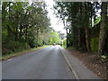
10
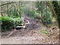
The Solent Way, Hythe.
Unfortunately very churned up by this now abandoned car.
Image: © Gillian Thomas
Taken: 28 Mar 2007
0.15 miles