IMAGES TAKEN NEAR TO
Hazel Grove, SOUTHAMPTON, SO40 7AJ
Introduction
This page details the photographs taken nearby to Hazel Grove, SO40 7AJ by members of the Geograph project.
The Geograph project started in 2005 with the aim of publishing, organising and preserving representative images for every square kilometre of Great Britain, Ireland and the Isle of Man.

There are currently over 7.5m images from over14,400 individuals and you can help contribute to the project by visiting https://www.geograph.org.uk
Image Map (Loading...)


Getting Data...Please wait
Leaflet Map data © OpenStreetMap
Images are licensed for reuse under creativecommons.org/licenses/by-sa/2.0
Notes
- Clicking on the map will re-center to the selected point.
- The higher the marker number, the further away the image location is from the centre of the postcode.
Image Listing (17 Images Found)
Images are licensed for reuse under creativecommons.org/licenses/by-sa/2.0
Image
Details
Distance
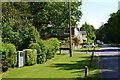
1
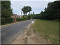
Woodlands, Fletchwood Lane
Lane from Woodlands Road, later becoming Woodlands Drove. Local authority signage is "Fletchwood Lane", rather than "Fletchwood Road" as stated by OS.
Image: © Mike Faherty
Taken: 19 Sep 2015
0.11 miles
2
Woodlands, cattle grid
Leaving Open Forest on Woodlands Road.
Image: © Mike Faherty
Taken: 18 Sep 2015
0.13 miles
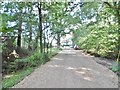
3
Woodlands, gateway
Bridleway and farm road at Fletchwood Lane.
Image: © Mike Faherty
Taken: 19 Sep 2015
0.14 miles
4
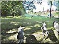
Ashurst, pannage pigs
A trio doing what pannage pigs are supposed to do, foraging for acorns, here landing beneath their snouts. These pigs have wandered about 680m since they were photographed the previous day Image
Image: © Mike Faherty
Taken: 19 Sep 2015
0.14 miles
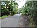
6
Fletchwood Copse from Fletchwood Lane
Fletchwood Copse is similar to the Inclosures (plantations) of the adjacent New Forest, but is privately owned. Bartley Water meanders through the northern part of the copse. The boundary bank is in the foreground, and the oak and beech trunks on the left and right are growing on the bank.
Image: © Jim Champion
Taken: 12 Mar 2006
0.17 miles
7
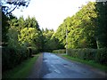
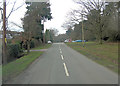
Woodlands Road, near the junction with Fletchwood Lane
Image: © David Martin
Taken: 6 Jun 2018
0.18 miles
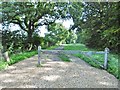
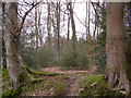
9
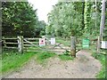
Costicles Inclosure, gates
Leading into the inclosure from Woodlands Road.
Image: © Mike Faherty
Taken: 18 Sep 2015
0.19 miles