IMAGES TAKEN NEAR TO
Brunel Road, SOUTHAMPTON, SO40 3WX
Introduction
This page details the photographs taken nearby to Brunel Road, SO40 3WX by members of the Geograph project.
The Geograph project started in 2005 with the aim of publishing, organising and preserving representative images for every square kilometre of Great Britain, Ireland and the Isle of Man.

There are currently over 7.5m images from over14,400 individuals and you can help contribute to the project by visiting https://www.geograph.org.uk
Image Map
Images are licensed for reuse under creativecommons.org/licenses/by-sa/2.0
Notes
- Clicking on the map will re-center to the selected point.
- The higher the marker number, the further away the image location is from the centre of the postcode.
Image Listing (14 Images Found)
Images are licensed for reuse under creativecommons.org/licenses/by-sa/2.0
Image
Details
Distance
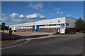
1

Nutsey Close, Totton
Access to Waterworks
Image: © Alex McGregor
Taken: 30 Mar 2010
0.08 miles
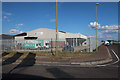
3

Open area, near Nutsey Close, Totton
Spring yet to happen
Image: © Alex McGregor
Taken: 30 Mar 2010
0.11 miles
5

River Blackwater, Totton
River full of winter rain
Image: © Alex McGregor
Taken: 30 Mar 2010
0.14 miles
7
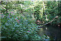
Himalayan Balsam by the River Test
An invasive non-native that often grows along rivers.
Image: © Hugh Venables
Taken: 12 Jul 2019
0.15 miles