IMAGES TAKEN NEAR TO
Yeomans Way, SOUTHAMPTON, SO40 3JW
Introduction
This page details the photographs taken nearby to Yeomans Way, SO40 3JW by members of the Geograph project.
The Geograph project started in 2005 with the aim of publishing, organising and preserving representative images for every square kilometre of Great Britain, Ireland and the Isle of Man.

There are currently over 7.5m images from over14,400 individuals and you can help contribute to the project by visiting https://www.geograph.org.uk
Image Map
Images are licensed for reuse under creativecommons.org/licenses/by-sa/2.0
Notes
- Clicking on the map will re-center to the selected point.
- The higher the marker number, the further away the image location is from the centre of the postcode.
Image Listing (72 Images Found)
Images are licensed for reuse under creativecommons.org/licenses/by-sa/2.0
Image
Details
Distance
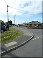
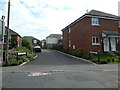
2
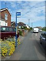
Looking from Water Lane into Sunset Road
Image: © Basher Eyre
Taken: 29 Jun 2011
0.09 miles
3
Looking from Sunset Road into Windermere Gardens
Image: © Basher Eyre
Taken: 29 Jun 2011
0.09 miles
4
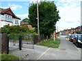
Looking from Salisbury Road into Mayfield Avenue
Image: © Basher Eyre
Taken: 26 Mar 2012
0.09 miles
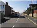
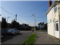
5
Looking from Sunset Road into Water Lane
Image: © Basher Eyre
Taken: 29 Jun 2011
0.10 miles
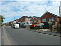
7
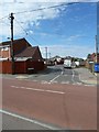
Looking from Water Lane into Wickham Court
Image: © Basher Eyre
Taken: 29 Jun 2011
0.11 miles
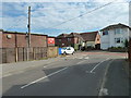
8
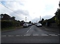
Looking from Stannington Crescent out onto the A36
Image: © Basher Eyre
Taken: 26 Mar 2012
0.12 miles