IMAGES TAKEN NEAR TO
Florence Way, SO31 5JE
Introduction
This page details the photographs taken nearby to Florence Way, SO31 5JE by members of the Geograph project.
The Geograph project started in 2005 with the aim of publishing, organising and preserving representative images for every square kilometre of Great Britain, Ireland and the Isle of Man.

There are currently over 7.5m images from over14,400 individuals and you can help contribute to the project by visiting https://www.geograph.org.uk
Image Map
Images are licensed for reuse under creativecommons.org/licenses/by-sa/2.0
Notes
- Clicking on the map will re-center to the selected point.
- The higher the marker number, the further away the image location is from the centre of the postcode.
Image Listing (11 Images Found)
Images are licensed for reuse under creativecommons.org/licenses/by-sa/2.0
Image
Details
Distance

2
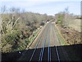
Netley, railway lines
Looking towards Southampton from Grange Road road bridge.
Image: © Mike Faherty
Taken: 18 Jan 2020
0.08 miles
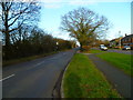
3
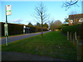
Grange Road looking north from the west end of Cranmore
Image: © Shazz
Taken: 15 Feb 2013
0.08 miles
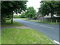
5
The south west end of Calbourne
Very tight parking is seen on the left.
Image: © Shazz
Taken: 15 Feb 2013
0.16 miles
7
Grange Road looking towards the railway bridge
Image: © Shazz
Taken: 15 Feb 2013
0.17 miles
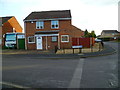
8
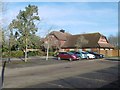
Netley, Dancing Goose
Public house and restaurant on Grange Road. Internally, open plan, with back counter, eating and drinking areas front and right; balcony, garden, carvery. Cask ales on offer: Dancing Goose Light, Sharp's Atlantic & Doom Bar, Wadworth 6X.
Image: © Mike Faherty
Taken: 18 Jan 2020
0.18 miles
9
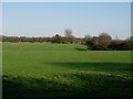
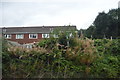
Butlocks Heath
Typical urban fringe farmland - some horses in the corner
Image: © Footprints
Taken: 6 Apr 2006
0.20 miles
10
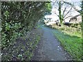
Netley, footpath
From St. Mary's Road to Grange Road, following the railway line (left, out of sight); right, suburban housing.
Image: © Mike Faherty
Taken: 18 Jan 2020
0.22 miles