IMAGES TAKEN NEAR TO
West Tisted, ALRESFORD, SO24 0HJ
Introduction
This page details the photographs taken nearby to SO24 0HJ by members of the Geograph project.
The Geograph project started in 2005 with the aim of publishing, organising and preserving representative images for every square kilometre of Great Britain, Ireland and the Isle of Man.

There are currently over 7.5m images from over14,400 individuals and you can help contribute to the project by visiting https://www.geograph.org.uk
Image Map
Images are licensed for reuse under creativecommons.org/licenses/by-sa/2.0
Notes
- Clicking on the map will re-center to the selected point.
- The higher the marker number, the further away the image location is from the centre of the postcode.
Image Listing (41 Images Found)
Images are licensed for reuse under creativecommons.org/licenses/by-sa/2.0
Image
Details
Distance
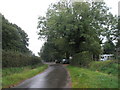
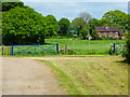
1
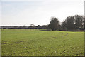
Looking across farmland towards West Tisted
Image: © Anonymous 4452
Taken: 21 Jan 2006
0.01 miles
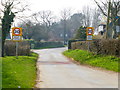
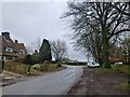
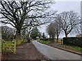
3
Road junction in West Tisted
The camera is in Punsholt Lane.
Image: © Shazz
Taken: 14 Mar 2014
0.05 miles
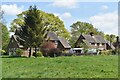
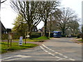
10
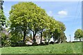
Line of trees and former vicarage, West Tisted
There is no indication on the ground that this was the vicarage, but it has the appearance, confirmed by historic OS mapping.
Image: © David Martin
Taken: 30 Apr 2022
0.12 miles