IMAGES TAKEN NEAR TO
Petersfield Road, ALRESFORD, SO24 0EE
Introduction
This page details the photographs taken nearby to Petersfield Road, SO24 0EE by members of the Geograph project.
The Geograph project started in 2005 with the aim of publishing, organising and preserving representative images for every square kilometre of Great Britain, Ireland and the Isle of Man.

There are currently over 7.5m images from over14,400 individuals and you can help contribute to the project by visiting https://www.geograph.org.uk
Image Map
Images are licensed for reuse under creativecommons.org/licenses/by-sa/2.0
Notes
- Clicking on the map will re-center to the selected point.
- The higher the marker number, the further away the image location is from the centre of the postcode.
Image Listing (27 Images Found)
Images are licensed for reuse under creativecommons.org/licenses/by-sa/2.0
Image
Details
Distance
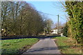
1
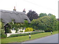
Petersfield Road, Ropley
Thatched cottage on one of the main roads in the sprawling village of Ropley.
Image: © Colin Smith
Taken: 11 Jun 2011
0.03 miles
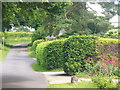
2
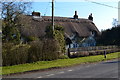
Thatched cottage on Petersfield Road at Ropley
Image: © David Martin
Taken: 24 Feb 2018
0.03 miles
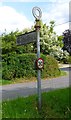
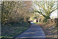
3
Hook Lane, Ropley
Village signpost with view along rural Hook Lane which leads to the parish church, about 1 mile away.
Image: © Colin Smith
Taken: 11 Jun 2011
0.04 miles
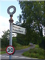
4
Direction Sign - Signpost by Hook Lane, Ropley parish
Annulus finial - 1 Worboys arm; Hampshire Parish halo by the UC road, in parish of Ropley (East Hampshire District), opposite Hook Lane, on grass triangle.
Surveyed
Milestone Society National ID: HA_SU6231
Image: © Milestone Society
Taken: Unknown
0.04 miles
5
Junction of Hook Lane and Petersfield Road at Ropley
Image: © David Martin
Taken: 24 Feb 2018
0.06 miles
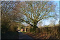
6
Hook Lane
Narrow and quiet residential lane in the sprawling village of Ropley.
Image: © Colin Smith
Taken: 11 Jun 2011
0.07 miles
9
View from Tegg Down Road
Looking towards Ropley station.
Image: © Robin Webster
Taken: 9 Jul 2013
0.12 miles
10
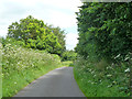
Hook Lane, Ropley
The profuse umbellifer is Hogweed.
Image: © Robin Webster
Taken: 15 Jul 2014
0.16 miles