
IMAGES TAKEN NEAR TO
Grange Road, WINCHESTER, SO23 9RT
Introduction
This page details the photographs taken nearby to Grange Road, SO23 9RT by members of the Geograph project.
The Geograph project started in 2005 with the aim of publishing, organising and preserving representative images for every square kilometre of Great Britain, Ireland and the Isle of Man.

There are currently over 7.5m images from over14,400 individuals and you can help contribute to the project by visiting https://www.geograph.org.uk
Image Map
Images are licensed for reuse under creativecommons.org/licenses/by-sa/2.0
Notes
- Clicking on the map will re-center to the selected point.
- The higher the marker number, the further away the image location is from the centre of the postcode.
Image Listing (53 Images Found)
Images are licensed for reuse under creativecommons.org/licenses/by-sa/2.0
Image
Details
Distance
1
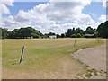
St Cross, cricket club
One of two pitches at St Cross Symondians Cricket Club. http://www.stcrosscc.co.uk/
Image: © Mike Faherty
Taken: 24 Jul 2013
0.07 miles
2
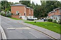
Housing in Grange Road
The northern part of Grange Road slopes upwards to Grange Close. I'm not sure if these new looking buildings are houses or flats.
Image: © Peter Facey
Taken: 1 Sep 2008
0.10 miles
3
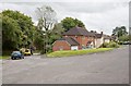
Junction of Grange Road and Grange Close
Grange Road is the one on the left.
Image: © Peter Facey
Taken: 1 Sep 2008
0.10 miles
4
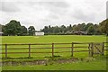
St Cross Cricket Club playing field
This is the northern of two fields, seen from farmland linked to St Cross Hospital. For the Cricket Club see http://www.stcrosscc.co.uk/
Image: © Peter Facey
Taken: 1 Sep 2008
0.10 miles
5
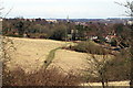
Bushfield, Winchester
Looking NE towards Winchester across the Bushfield dry valley. A typical area of conflict on the urban fringe, now open to walkers again after much controversy when it was fenced for grazing.
Image: © Pierre Terre
Taken: 6 Apr 2006
0.11 miles
6
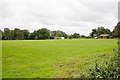
St Cross Cricket Club playing field
The southern of two cricket fields. See http://www.stcrosscc.co.uk/
Image: © Peter Facey
Taken: 1 Sep 2008
0.11 miles
8
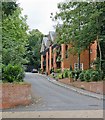
Argyll Court, St Cross Road
Looks recently built. Not on OS maps. Subject coords may need small revision. May be part of http://www.greensleeves.org.uk/stcross.html
Image: © Peter Facey
Taken: 1 Sep 2008
0.12 miles
9
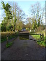
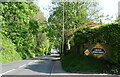
Five Bridges Road
Just after the white railings are footpaths to right and left.
Image: © Shazz
Taken: 3 Dec 2011
0.12 miles
10
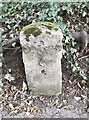
Old Milestone by the B3335, St Cross Road, Winchester
Stone post (plate lost) by the B3335, in parish of WINCHESTER (WINCHESTER District), St Cross Road, Winchester, in hedge bank in front of St. Cross Park, on East side of road. Erected by the Southampton, North District turnpike trust in the 19th century.
Inscription once read:-
(1 Mile)
(to)
(Winchester)
Carved benchmark and rivet on top.
Grade II listed.
List Entry Number: 1095376 https://historicengland.org.uk/listing/the-list/list-entry/1095376
Milestone Society National ID: HA_WISO01.
Image: © Gail Fawcett
Taken: 23 Sep 2023
0.14 miles