IMAGES TAKEN NEAR TO
Water Lane, WINCHESTER, SO23 0EJ

Introduction

This page details the photographs taken nearby to Water Lane, SO23 0EJ by members of the Geograph project.

The Geograph project started in 2005 with the aim of publishing, organising and preserving representative images for every square kilometre of Great Britain, Ireland and the Isle of Man.

There are currently over 7.5m images from over14,400 individuals and you can help contribute to the project by visiting https://www.geograph.org.uk

Image Map


Images are licensed for reuse under creativecommons.org/licenses/by-sa/2.0
Notes
  • Clicking on the map will re-center to the selected point.
  • The higher the marker number, the further away the image location is from the centre of the postcode.

Image Listing (928 Images Found)

Images are licensed for reuse under creativecommons.org/licenses/by-sa/2.0
  • ...
Image
Details
Distance
1
Water Lane after snow, Winchester
Seen from a footpath linking its closed end with Bridge Street.
Image: © Peter Facey Taken: 3 Feb 2009
0.01 miles
2
Lamppost in Water Lane
Image: © Basher Eyre Taken: 17 Oct 2009
0.01 miles
3
Winchester: City Mill
Straddling the Itchen, this old mill was the city's Youth Hostel from 1931 until 2005. For more information on former youth hostels in Great Britain and Ireland, see https://www.geograph.org.uk/article/Former-youth-hostels-of-Great-Britain.
Image: © Christopher Hilton Taken: 5 Sep 2010
0.02 miles
4
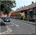
Water Lane, Winchester
The houses are about 40 metres east of the River Itchen, out of shot on the left.
Image: © Jaggery Taken: 28 Sep 2014
0.02 miles
5
Start of cut through from St John's Street to Water Lane
Image: © Basher Eyre Taken: 17 Oct 2009
0.02 miles
6
Weeping willows in Water Lane (2)
Image: © Basher Eyre Taken: 17 Oct 2009
0.02 miles
7
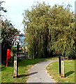
Watervole Trail to Winnall Moors, Winchester
On the west side of Water Lane, the trail is along a bank of the River Itchen. Hampshire & Isle of Wight Wildlife Trust information posts are alongside the trail. The one on the left describes the mayfly which can spend up to two years as a nymph then live for just one day as an adult on the wing. There are 51 species of mayfly in Britain, a vital part of the food chain for fish such as brown trout, which is featured on the post on the right. The brown trout, Salmo trutta, is a predatory fish feeding on invertebrates including mayflies. They need fast-flowing gravelly rivers in which to spawn. Trout scales have growth rings which show that the fish can live to the age of 20.
Image: © Jaggery Taken: 28 Sep 2014
0.02 miles
8
City Mills, Winchester
A National Trust property which was rebuilt in 1744. The slight wonkiness of the gable is real. It is powered by the River Itchen. See also Image
Image: © Peter Facey Taken: 3 Jul 2008
0.03 miles
9
City Mill, Winchester
The building now houses a museum
Image: © Dr Neil Clifton Taken: 4 Jun 2009
0.03 miles
10
St. John's Street, SO23
Image: © Mike Quinn Taken: 14 Nov 2012
0.03 miles
  • ...