IMAGES TAKEN NEAR TO
Crouchers Croft, WINCHESTER, SO22 5NX
Introduction
This page details the photographs taken nearby to Crouchers Croft, SO22 5NX by members of the Geograph project.
The Geograph project started in 2005 with the aim of publishing, organising and preserving representative images for every square kilometre of Great Britain, Ireland and the Isle of Man.

There are currently over 7.5m images from over14,400 individuals and you can help contribute to the project by visiting https://www.geograph.org.uk
Image Map
Images are licensed for reuse under creativecommons.org/licenses/by-sa/2.0
Notes
- Clicking on the map will re-center to the selected point.
- The higher the marker number, the further away the image location is from the centre of the postcode.
Image Listing (20 Images Found)
Images are licensed for reuse under creativecommons.org/licenses/by-sa/2.0
Image
Details
Distance
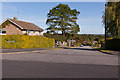
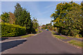
1
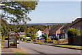
Grovelands Road
Looking across the city of Winchester from Grovelands Road which is fairly high up. The area in the distance would be Harestock and Weeke.
Image: © Peter Facey
Taken: 22 Sep 2012
0.11 miles
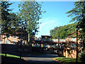
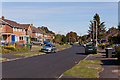
2
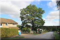
Grovelands Road, Winchester
About a quarter of SU4530 is suburbs like this. The rest is farmland.
Image: © Des Blenkinsopp
Taken: 21 Aug 2018
0.13 miles
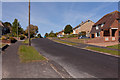
3
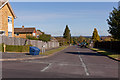
Southern end of Hillside Road
Looking across Teg Down Meads.
Image: © Peter Facey
Taken: 22 Sep 2012
0.14 miles
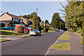
4
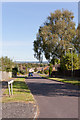
Southern end of Webster Road
Seen from Teg Down Meads.
Image: © Peter Facey
Taken: 22 Sep 2012
0.17 miles
5
Southern end of Grovelands Road
Seen from Teg Down Meads.
Image: © Peter Facey
Taken: 22 Sep 2012
0.18 miles
6
Wyke Mark, Winchester
One of the many new housing developments on in-fill sites in Winchester, Wyke Mark is situated on Dean Lane, a woody lane leading north-westwards out of Winchester.
Image: © Peter Jordan
Taken: 7 Sep 2005
0.19 miles
7
Looking up Teg Down Meads
From opposite number 104. The next turning on the right, where the green car is, is Hillside Road.
Image: © Peter Facey
Taken: 22 Sep 2012
0.20 miles
8
Looking towards the top end of Teg Down Meads
From junction with Webster Road.
Image: © Peter Facey
Taken: 22 Sep 2012
0.21 miles
9
Looking down Teg Down Meads
From outside number 71.
Image: © Peter Facey
Taken: 22 Sep 2012
0.21 miles
10
Top end of Teg down Meads
With cul de sac named Beech Copse on the left.
Image: © Peter Facey
Taken: 22 Sep 2012
0.21 miles