IMAGES TAKEN NEAR TO
Airlie Road, WINCHESTER, SO22 4NQ
Introduction
This page details the photographs taken nearby to Airlie Road, SO22 4NQ by members of the Geograph project.
The Geograph project started in 2005 with the aim of publishing, organising and preserving representative images for every square kilometre of Great Britain, Ireland and the Isle of Man.

There are currently over 7.5m images from over14,400 individuals and you can help contribute to the project by visiting https://www.geograph.org.uk
Image Map
Images are licensed for reuse under creativecommons.org/licenses/by-sa/2.0
Notes
- Clicking on the map will re-center to the selected point.
- The higher the marker number, the further away the image location is from the centre of the postcode.
Image Listing (136 Images Found)
Images are licensed for reuse under creativecommons.org/licenses/by-sa/2.0
Image
Details
Distance
1
Junction of Sparkford Road and Sleepers Hill
Image: © Basher Eyre
Taken: 17 Oct 2009
0.02 miles
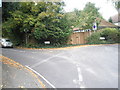
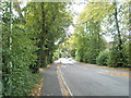
2
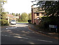
Junction of Sparkford Road and Airlie Road
Image: © Basher Eyre
Taken: 17 Oct 2009
0.02 miles
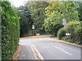
4
Approaching the junction of Airlie Road and Airlie Lane
Image: © Basher Eyre
Taken: 17 Oct 2009
0.03 miles
5
Looking from Airlie Road into St Cross Mews
Image: © Basher Eyre
Taken: 17 Oct 2009
0.03 miles
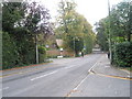
7
Approaching the junction of Sparkford Road and Sleepers Delle Gardens
Image: © Basher Eyre
Taken: 17 Oct 2009
0.03 miles
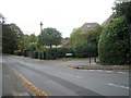
8
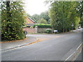
Approaching the junction of Airlie Road and Wentworth Grange
Image: © Basher Eyre
Taken: 17 Oct 2009
0.04 miles
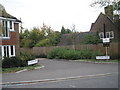
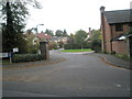
9
Wentworth Grange, Winchester
Residential cul-de-sac on the north side of Airlie Road.
Image: © Jaggery
Taken: 28 Sep 2014
0.04 miles
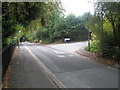
10
Looking from Airlie Road into Wentworth Grange
Image: © Basher Eyre
Taken: 17 Oct 2009
0.05 miles