IMAGES TAKEN NEAR TO
Wonston Close, WINCHESTER, SO21 3LQ
Introduction
This page details the photographs taken nearby to Wonston Close, SO21 3LQ by members of the Geograph project.
The Geograph project started in 2005 with the aim of publishing, organising and preserving representative images for every square kilometre of Great Britain, Ireland and the Isle of Man.

There are currently over 7.5m images from over14,400 individuals and you can help contribute to the project by visiting https://www.geograph.org.uk
Image Map
Images are licensed for reuse under creativecommons.org/licenses/by-sa/2.0
Notes
- Clicking on the map will re-center to the selected point.
- The higher the marker number, the further away the image location is from the centre of the postcode.
Image Listing (40 Images Found)
Images are licensed for reuse under creativecommons.org/licenses/by-sa/2.0
Image
Details
Distance
1
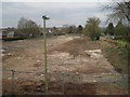
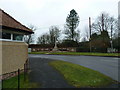
Sutton Scotney railway station (site), Hampshire, 2017
Opened in 1885 by the Didcot Newbury & Southampton Railway, later part of the Great Western Railway, on the line from Newbury to Winchester (Chesil), this station closed to passengers in 1960.
View north towards Barton Stacey and Newbury. The site had recently been cleared ready for a new housing development.
Image: © Nigel Thompson
Taken: 23 Mar 2017
0.11 miles
2
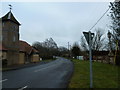
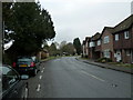
Wonston Road on a gloomy December afternoon
Image: © Basher Eyre
Taken: 30 Dec 2010
0.16 miles
3
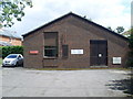
Telephone Exchange, Sutton Scotney
Situated in Oxford Road, this modern redbrick TE serves Sutton Scotney, plus Barton Stacey, Lower Bullington, Stoke Charity, Upper Bullington and Wonston nearby. Besides the BT warning notices, this TE also has a red notice which says "This area has been designated for the use only by Royal Mail. For parking up to three vehicles". The numbering range for this TE is (01962) 76xxxx, the (01962) referring to the Winchester group of TEs. Its postcode is SO21 3JG.
Image: © David Hillas
Taken: 8 Jul 2011
0.18 miles
4
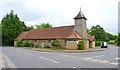
Victoria Hall on a gloomy December afternoon
Image: © Basher Eyre
Taken: 30 Dec 2010
0.19 miles
6
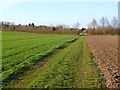
Farmland, Sutton Scotney, Wonston
A footpath in arable fields to the south of the village.
Image: © Andrew Smith
Taken: 11 Mar 2012
0.19 miles
8
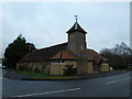
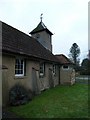
Victoria Hall, Sutton Scotney
This community hall is home to many groups and societies that meet on a regular basis. It is also available for hire for private parties.
Image: © mike smith
Taken: 5 Aug 2013
0.19 miles
9
Looking from Victoria Hall across Wonston Road towards the War Memorial
Image: © Basher Eyre
Taken: 30 Dec 2010
0.20 miles
10
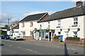
Dever Stores, Sutton Scotney
Named after the River Dever that passes through the village. This road used to be the main A34 and as it crossed the A30 just north of here there was always a traffic bottleneck in Sutton Scotney. Now it has all been bypassed and the village is quieter. The only bottleneck today was someone parking inconsiderately on the left (shadow just seen) at the narrowest part of the road to pop into the stores.
Image: © Graham Horn
Taken: 7 Apr 2011
0.20 miles