IMAGES TAKEN NEAR TO
East Stratton, WINCHESTER, SO21 3DZ
Introduction
This page details the photographs taken nearby to SO21 3DZ by members of the Geograph project.
The Geograph project started in 2005 with the aim of publishing, organising and preserving representative images for every square kilometre of Great Britain, Ireland and the Isle of Man.

There are currently over 7.5m images from over14,400 individuals and you can help contribute to the project by visiting https://www.geograph.org.uk
Image Map
Images are licensed for reuse under creativecommons.org/licenses/by-sa/2.0
Notes
- Clicking on the map will re-center to the selected point.
- The higher the marker number, the further away the image location is from the centre of the postcode.
Image Listing (18 Images Found)
Images are licensed for reuse under creativecommons.org/licenses/by-sa/2.0
Image
Details
Distance
2
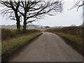
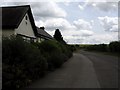
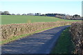
Entrance to Burcot Farm
On the eastern side of the road between East Stratton and Northington. Note the small pond.
Image: © Peter Jordan
Taken: 8 Jul 2006
0.04 miles
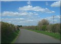
3
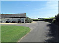
Buildings at Burcot Farm
On the eastern side of the road from East Stratton to Northington.
Image: © Peter Jordan
Taken: 8 Jul 2006
0.07 miles
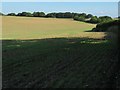
8
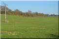
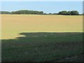
Gently sloping field south of Burcot Farm
Image: © David Martin
Taken: 26 Feb 2019
0.18 miles