IMAGES TAKEN NEAR TO
Bourne Close, WINCHESTER, SO21 2DU
Introduction
This page details the photographs taken nearby to Bourne Close, SO21 2DU by members of the Geograph project.
The Geograph project started in 2005 with the aim of publishing, organising and preserving representative images for every square kilometre of Great Britain, Ireland and the Isle of Man.

There are currently over 7.5m images from over14,400 individuals and you can help contribute to the project by visiting https://www.geograph.org.uk
Image Map
Images are licensed for reuse under creativecommons.org/licenses/by-sa/2.0
Notes
- Clicking on the map will re-center to the selected point.
- The higher the marker number, the further away the image location is from the centre of the postcode.
Image Listing (21 Images Found)
Images are licensed for reuse under creativecommons.org/licenses/by-sa/2.0
Image
Details
Distance
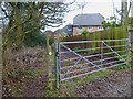
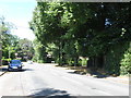
2
Looking through the M3 bridge over Poles Lane
This can also be seen at http://www.geograph.org.uk/photo/28477.
Image: © Shazz
Taken: 18 Mar 2013
0.06 miles
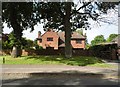
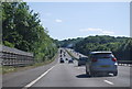
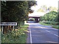
5
Poles Lane, Otterbourne
The turning for Norlands Drive is on the right.
Image: © Robin Webster
Taken: 13 Feb 2017
0.09 miles
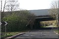
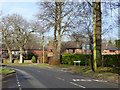
7
Poles Lane, Otterbourne
The M3 can be seen bridging Poles Lane
Image: © Steve Rigg
Taken: 16 Jul 2005
0.11 miles
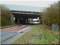
8
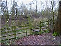
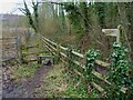
Change of direction
The path used to carry straight on but now has to go left by the side of the motorway embankment and take the long way round. The signpost has seen better days.
Image: © Shazz
Taken: 18 Mar 2013
0.11 miles