IMAGES TAKEN NEAR TO
Grove Road, WINCHESTER, SO21 2DD
Introduction
This page details the photographs taken nearby to Grove Road, SO21 2DD by members of the Geograph project.
The Geograph project started in 2005 with the aim of publishing, organising and preserving representative images for every square kilometre of Great Britain, Ireland and the Isle of Man.

There are currently over 7.5m images from over14,400 individuals and you can help contribute to the project by visiting https://www.geograph.org.uk
Image Map
Images are licensed for reuse under creativecommons.org/licenses/by-sa/2.0
Notes
- Clicking on the map will re-center to the selected point.
- The higher the marker number, the further away the image location is from the centre of the postcode.
Image Listing (17 Images Found)
Images are licensed for reuse under creativecommons.org/licenses/by-sa/2.0
Image
Details
Distance
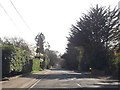
1
Development site, Otterbourne Road
See also http://www.geograph.org.uk/photo/2629043
Image: © Peter Facey
Taken: 2 Oct 2011
0.10 miles
2

Development site, Otterbourne Road
Formerly the site of the Captain Barnard pub, which ceased trading in 2007. Soon to be a 65 bedroom residential care home built by the Highwood Group http://www.highwoodgroup.co.uk/ . See also http://www.geograph.org.uk/photo/2629048
Image: © Peter Facey
Taken: 2 Oct 2011
0.11 miles
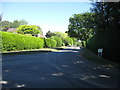
6
Tilden Road junction from Otterbourne Road
Image: © John Firth
Taken: 1 Apr 2014
0.15 miles