IMAGES TAKEN NEAR TO
Shawford, WINCHESTER, SO21 2AG
Introduction
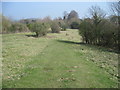
This page details the photographs taken nearby to SO21 2AG by members of the Geograph project.
The Geograph project started in 2005 with the aim of publishing, organising and preserving representative images for every square kilometre of Great Britain, Ireland and the Isle of Man.

There are currently over 7.5m images from over14,400 individuals and you can help contribute to the project by visiting https://www.geograph.org.uk
Image Map
Images are licensed for reuse under creativecommons.org/licenses/by-sa/2.0
Notes
- Clicking on the map will re-center to the selected point.
- The higher the marker number, the further away the image location is from the centre of the postcode.
Image Listing (92 Images Found)
Images are licensed for reuse under creativecommons.org/licenses/by-sa/2.0
Image
Details
Distance

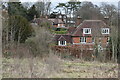

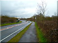
5
Shawford Road housing, west of railway
Looking NNE from Shawford Down. Railway station is off picture to right. M3 is off picture to left. These houses line Shawford Road. Residential area behind them, shielded by trees, is Red Lane and Combe Down.
Image: © Peter Facey
Taken: 9 Oct 2005
0.09 miles