IMAGES TAKEN NEAR TO
Twyford, WINCHESTER, SO21 1PH
Introduction
This page details the photographs taken nearby to SO21 1PH by members of the Geograph project.
The Geograph project started in 2005 with the aim of publishing, organising and preserving representative images for every square kilometre of Great Britain, Ireland and the Isle of Man.

There are currently over 7.5m images from over14,400 individuals and you can help contribute to the project by visiting https://www.geograph.org.uk
Image Map (Loading...)


Getting Data...Please wait
Leaflet Map data © OpenStreetMap
Images are licensed for reuse under creativecommons.org/licenses/by-sa/2.0
Notes
- Clicking on the map will re-center to the selected point.
- The higher the marker number, the further away the image location is from the centre of the postcode.
Image Listing (6 Images Found)
Images are licensed for reuse under creativecommons.org/licenses/by-sa/2.0
Image
Details
Distance
2
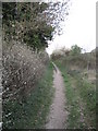
Footpath between Hockley golf course and Twyford
Image: © Caroline Maynard
Taken: 3 Apr 2011
0.16 miles
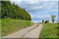
3
White Lane
A narrow bridleway that goes towards the busy B3335.
Image: © T Eyre
Taken: 22 Aug 2022
0.16 miles