IMAGES TAKEN NEAR TO
Tunstall Road, SOUTHAMPTON, SO19 6NZ
Introduction
This page details the photographs taken nearby to Tunstall Road, SO19 6NZ by members of the Geograph project.
The Geograph project started in 2005 with the aim of publishing, organising and preserving representative images for every square kilometre of Great Britain, Ireland and the Isle of Man.

There are currently over 7.5m images from over14,400 individuals and you can help contribute to the project by visiting https://www.geograph.org.uk
Image Map
Images are licensed for reuse under creativecommons.org/licenses/by-sa/2.0
Notes
- Clicking on the map will re-center to the selected point.
- The higher the marker number, the further away the image location is from the centre of the postcode.
Image Listing (11 Images Found)
Images are licensed for reuse under creativecommons.org/licenses/by-sa/2.0
Image
Details
Distance
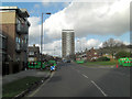
2
Southampton : Residential Towers & Scenery
Residential towers in the Sholing area of Southampton from a plane which had just taken off from the airport.
Image: © Lewis Clarke
Taken: 23 Aug 2012
0.07 miles
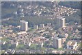
3
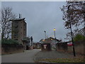
Hightown Towers
Hightown Towers greets you onto this large social housing estate.
A 60s blot on the landscape? or a "penthouse" with a view over Southampton....You decide.
Image: © dinglefoot
Taken: 31 Dec 2009
0.14 miles
4
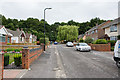
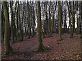
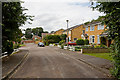
Southern end of Ellis Road
The road comes to an end at Dumbleton's Copse, ahead.
Image: © Peter Facey
Taken: 14 Jul 2009
0.15 miles
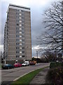
5
Tower Blocks & The Woodland Walks
These Tower blocks of social housing flats, look down on wonderful woodland walks.
Image: © dinglefoot
Taken: 31 Dec 2009
0.16 miles
9
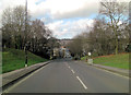
Copse View, Thornhill
Photographer has his back to the eponymous Dumbleton's Copse.
Image: © Peter Facey
Taken: 14 Jul 2009
0.23 miles
10
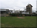
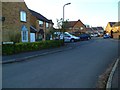
Ivy Dene Play Area
Off Ivy Dene the Ivy Dene play area overlooked by the training tower of Hightown Fire station
Image: © Shaun Ferguson
Taken: 16 Mar 2012
0.23 miles